Strath Polly
Dun (Prehistoric)
Site Name Strath Polly
Classification Dun (Prehistoric)
Canmore ID 4486
Site Number NC01SE 5
NGR NC 0785 1331
Datum OSGB36 - NGR
Permalink http://canmore.org.uk/site/4486
- Council Highland
- Parish Lochbroom
- Former Region Highland
- Former District Ross And Cromarty
- Former County Ross And Cromarty
NC01SE 5 0785 1331
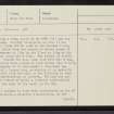
Surmounting a rocky knoll at NC 0785 1331 are the remains of a dun. Roughly triangular on plan it has measured about 13.0m E-W by 9.0m at the broader W end, within a wall which from the spread of debris seems to have varied between c. 2.0m in the E and c. 5.0m at the entrance midway along the W side. Few stones of either face survive. Inside the dun, some 3.5m from the E end, an overgrown stony bank spread to 2.0m curves from N to S, but it is uncertain if it represents a secondary re- construction of a larger dun, or whether it is actually the main dun wall with the wall to the E (which is less substantial) representing an outwork. The dun has un- doubtedly been robbed to build a circular rubble-built sheep fold at the foot of the knoll in the SE.
This fold appears to have been constructed on top of an earlier enclosure - possible a hut-circle, as the lower grass-covered courses indicate a wall thickness of c. 1.8m. Shieling bothies have been built into the fold and a few lie outside it.
Surveyed at 1/10,000.
Visited by OS (A A), 7 August 1974.


