
Craigmaddie Muir


Chambered Long Cairn (Neolithic)
Site Name Craigmaddie Muir
Classification Chambered Long Cairn (Neolithic)
Canmore ID 44414
Site Number NS57NE 17
NGR NS 58609 76474
Datum OSGB36 - NGR
Permalink http://canmore.org.uk/site/44414


- Council East Dunbartonshire
- Parish Baldernock (Strathkelvin)
- Former Region Strathclyde
- Former District Strathkelvin
- Former County Stirlingshire
NS57NE 17 5859 7646.
(NS 5859 7646) Chambered Cairn (NR) (remains of)
OS 1:10000 map (1976)
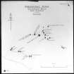
This Clyde type long cairn has been greatly robbed, but appears to have been about 77' long (or about 65' from the centre of the facade) by about 47' to 18' wide. The main axis lies N-S. A ridge of cairn material 2' - 3' high, remains at the S end of the cairn. The central area of the cairn has been completely robbed, but at the N end cairn material remains around the structural stones, and at the NE corner still stands 4' high. The present edge of the cairn material has the appearance of roughly representing the original cairn edge.
A S Henshall 1972; RCAHMS 1963
This chambered cairn is as described and planned.
Surveyed at 1:2500.
Visited by OS (WDJ) 3 May 1966
Field Visit (November 1981)
Craigmaddie Muir (STR 2) NS 585 764 NS57NE 17
A severely robbed chambered long cairn of Clyde type is situated on Craigmaddie Muir about 600m NE of North Blochairn farmhouse; it measures 23.5m from N to S by a maximum of 14.3m transversely; at the N end part of the chamber and a facade are visible.
RCAHMS 1982, visited November 1981
(RCAHMS 1963, p. 64, No. 32; Henshall 1972, 492-3)

