
Dunwan Hill


Fort (Prehistoric)
Site Name Dunwan Hill
Classification Fort (Prehistoric)
Alternative Name(s) Dunwan
Canmore ID 43771
Site Number NS54NW 1
NGR NS 54684 48955
Datum OSGB36 - NGR
Permalink http://canmore.org.uk/site/43771


- Council East Renfrewshire
- Parish Eaglesham
- Former Region Strathclyde
- Former District Eastwood
- Former County Renfrewshire
NS54NW 1 54684 48955
(NS 5468 4894) Fort (NR)
OS 6" map (1961).
Location formerly entered as NS 5468 4894.
Dunwan Hill, an isolated hill, has traces of a rampart or wall round the edge of its flat summit (about 975ft OD) and vague traces of two other walls, halfway down and at the base of the slopes respectively. These are most apparent on the north and east sides. The lower wall appears to be associated with a small steading on the north side of the hill, and may therefore be unrelated to the defences.
Visible on RAF APs (541/A/527: 4015-16).
Visited by OS (JLD), 21 July 1955
This fort is triangular on plan, measuring 260ft by 160ft within a single wall or rampart originally at least 12ft thick. The interior contains surface traces to two circular timber framed houses. Traces of an outer line of defence can be followed round the lowest slopes of the hill.
R W Feachem 1963.
This fort is generally as described.
Surveyed at 1:2500.
Visited by OS (RD), 21 March 1966
The remains of the lower wall are confused by farmstead walls, and cannot be reliably related to the fort. Foundations on the footings of the north arm of the wall appear on a 1789 farm plan for Denwan, but the wall is not shown here or on any later map. Only the east wall was incorporated in later walls according to subsequent maps.
J Ainslie 1789; T C Welsh 1975.
Dunwan hillfort was recorded in detail and drawn by ACFA during a survey of the lands based around Dunwan, East Renfrewshire. The triangular-shaped hill top measures 70m x 45m. A number of low, turf-covered banks were noted, along with two slightly hollowed areas, which may be hut circles previously recorded. On the N side of the hill, within the enclosing wall, is a complex of enclosures of varying sizes, which may be associated with animal husbandary. The 12' spread of rampart described by Feachem in 1963 cannot now be seen, although there is still evidence of a substantial and elaborate entrance to the hilltop enclosure at the W-SW end.
S Hunter, R Hunter 2005.
Scheduled as 'Dunwan Hill, fort...'
Information from Historic Scotland, scheduling document dated 24 February 2011.
Field Visit (5 July 1954)
Fort, Dunwan.
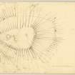
Dunwan Hill, which rises to a height of 980 feet OD two and a half miles SW of Eaglesham, stands near the northern limit of the tract of hilly marshland which occupies the southern part of Eaglesham parish. From the summit plateau the SE, NE and NW flanks fall steeply to the immediate base of the hill, while to the SW, after a similarly steep drop of 15 feet, a longer and easier slope descends to marshy ground through which runs a nameless tributary of the Blackwood Burn. The fort, which occupies the summit plateau, is triangular on plan [DP 149888] and measures 260 feet from NE to SW by 160 feet transversely within a wall or a terrace-rampart. The latter is now represented only by outer facing stones which appear sporadically on a line about 12 feet outside and as much below the NE, E and SE arcs of the present rim of the plateau. The entrance, 10 feet wide, is situated at the SE, at the apex of the triangle. The interior is covered with coarse pasture and patches of rushes and contains what may be the remains of hut circles. One of these, situated 50 feet NE. of the entrance, consists of a shallow trench about 2 feet in width enclosing an area which measures about 26 feet in diameter. A causeway about 4 feet in width in the N. arc probably represents the entrance. The other feature is an arc of a similar trench measuring 33 feet in length and forming part of a circle out 22 feet in diameter.
Immediately outside the entrance to the fort a slightly hollowed track runs down the steep slope for a distance of 50 feet to die out where the more gently sloping SE flank of the hill starts. At this point the line of the track is flanked by the ends of two ditches, 10 feet in width and 20 feet apart, and immediately outside those are the ends of a low stony mound, spread to a width of about 13 feet, which must represent a very decayed outer rampart. The gap in the rampart is crossed by a modern but ruinous dyke which runs along the top of the rampart and, in the centre of the gap, is joined at right angles by another dyke that runs up the slope from the SW. To the SE of the entrance gap the mound soon becomes nothing more than a scarp and the ditch a terrace, and together these features run in an arc SE and E on to the S flank of the hill. For the first 90 feet they are accompanied by the dyke, which afterwards turns off SSE down the hill. The terrace having lapsed after a distance of 150 feet, a crest line representing the rampart can be followed for a further 70 feet before it fades on the steep rocky SSE. flank of the hill. To the of the entrance gap the scarp of the rampart is accompanied NNW for 50 feet by that terrace and for 70 feet by the dyke. Thereafter the crest line traverses the flank of the hill for 200 feet before fading out on the steep rocky slope. After a gap of 250 feet, during which it is possible to see only the faintest traces of the crest line, this can be distinguished again on the NE flank of the hill and followed thence E and SE for 100 feet, at which point there is a gap about 25 feet in width. Beyond this the crest line runs on for 150 feet before becoming lost on the E. flank of the hill. Examination of the air-photographs on which the fort was first observed (541/A/527, 4016-7) suggests that this crest line did originally encircle the hill completely.
The siting of a rampart so far down the slope is a striking feature; at the points 200 feet on either side of the entrance in the SE arc the vertical distance from the rim of the summit plateau to the crest-line is 50 feet, while at the opposite end of the site the horizontal separation is 160 feet.
The surface of the ground at the immediate base of the hill is confused with tumbled boulders, drainage trenches, field boundaries and, on the N, by the ruins of buildings. Among these are the fragmentary remains of what might possibly have been a third rampart, distant about 70 feet outside the second and running round at least the NW, NE and SE of the bottom of the hill. But the possibility that this belonged to the ruined buildings which are set just within it cannot be ruled out.
Visited by RCAHMS (RWF) 5 July 1954.
Reference (1957)
This site is noted in the ‘List of monuments discovered during the survey of marginal land (1951-5)’ (RCAHMS 1957, xiv-xviii).
Information from RCAHMS (GFG), 24 October 2012.
Note (8 August 2014 - 16 November 2016)
This fort comprises an inner and outer enclosure, the former taking in the summit of Dunwan Hill, and the latter a much larger area extending down the slope. Roughly triangular on plan, the interior of the inner enclosure measures about 74m from NE to SW by a maximum of 45m transversely (0.27ha), its extent defined by the lip of the summit area, but with evidence of a substantial stone rampart up to on the E and S flanks, now largely reduced to little more than a line of outer facing stones some 3.5m below the lip. A well-defined entrance can be seen at the apex of the SW end, with a hollowed track dropping down the slope below, while within the interior there are traces of two timber round-houses, each defined by a shallow groove about 0.6m in breadth. On the SW, where the outer rampart is overlain by a later stone dyke, the outer defences comprise a low stony bank with an internal ditch some 3m broad, but elsewhere little more than a scarp or terrace can be traced round the foot of the hill, enclosing an oval area measuring about 130m from NE to SW by 90m transversely (0.94ha); terminals to the ditch to either side of the bottom of the hollowed trackway dropping down from the inner entrance suggest that there was also an entrance in the outer defences on the SW. While the OS in 1955 suggested that this outer enclosure was possibly associated with later farming enclosures around the hill, as Richard Feachem observed, it appears a convincing if unusual enclosure on aerial photographs, and he also speculated that there was perhaps yet another rampart amongst the field banks about 20m beyond it.
Information from An Atlas of Hillforts of Great Britain and Ireland – 16 November 2016. Atlas of Hillforts SC1429

