
'Knockamillie Castle'


Castle (Medieval)
Site Name 'Knockamillie Castle'
Classification Castle (Medieval)
Alternative Name(s) Innellan
Canmore ID 40749
Site Number NS17SE 1
NGR NS 1522 7100
Datum OSGB36 - NGR
Permalink http://canmore.org.uk/site/40749


- Council Argyll And Bute
- Parish Dunoon And Kilmun
- Former Region Strathclyde
- Former District Argyll And Bute
- Former County Argyll
NS17SE 1 1522 7100.
(Name: NS 1522 7098) Castle (NR) (Ruin)
OS 6" map (1900)
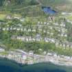
Although a great proportion of it was standing c.1835, by 1864, only a small portion of one of the angles remained of Knockamillie Castle, which stands on the high ground straight up from the pier at Innellan. Nothing can be made out as to its size or strength, which, however, has had a courtyard of considerable extent, and must have played part in the fighting and skirmishes here in the 16th and 17th centuries.
D MacGibbon and T Ross 1892; Name Book 1864
The remains of this castle consist of a portion of the S wall, with an open stairway, 6.0m long and 1.0m thick. A levelled area approximately 16.0m square outlined by earth-and-stone scarping lies to the N and W of the walling, while on the S is a curving scarp which ends at a modern wall.
Resurveyed at 1/2500.
Visited by OS (IA) 5 March 1973
The remains of Knockamillie Castle (name not verified) are as described in the report above.
Surveyed at 1/2500.
Visited by OS (TRG) 6 December 1976
Field Visit (May 1987)
The slight remains of this Campbell residence occupy a terrace at an elevation of 65m OD on the hillside 300m NW of Innellan Pier, enjoying a wide view of the Clyde coast and Bute. The surviving fragment of masonry is set mid-way along a natural scarp about 40m in length, and the W half of the platform has been occupied by an angular enclosure about 16m square bounded by low stony banks, with the building at its SE angle.
The surviving S-facing wall is 7m long and 0.85m thick, with a maximum height of about 7m. At ground level there is a narrow splayed opening which has been heavily robbed but retains some fragments of red sandstone, of the type found in the Toward area. Above this opening there is the W jamb of a rectangular window, 1.6m high and wrought with a 70mm roll-moulding; the ingo is splayed, and the sandstone rybats and springer of the arched embrasure remain in situ. A wall abutting this one at right angles appears to be of comparatively modern origin, intended as an open stair and a buttress to prevent the collapse of the original fragment, although its line is continued by some large stones in the E wall of the enclosure.
Knockamillie may have been included in the grant of the adjacent property of Cluniter in 1435 to the founder of the Campbell family of Auchenbreck (No. 1l2) (en1). Archibald, second son of Sir Duncan Campbell of Auchenbreck, was granted this and other lands in 1643 and subsequently used the designation 'of Knockmelling', but his son succeeded to the Auchenbreck estate (en.2). The site is not shown as a settlement of unusual importance on Pont's map of about 1590, and the surviving window details suggest a 17th-century date for thestructure (en.3). 'Mr Alexander Campbell his house' was assessed for three hearths in 1693 (en.4). The building was reported in 1864 as having been robbed during the preceding thirty years (en.5).
RCAHMS 1992, visited May 1987
Measured Survey (1987)
RCAHMS surveyed Knockamillie Castle in 1987 with plane-table and alidade producing a site plan at a scale of 1:400. The plan was redrawn in ink and published at a scale of 1:1000 (RCAHMS 1992, 295).

