
Bute, Upper Ardroscadale, Watch Hill


Burial Cairn (Period Unassigned)
Site Name Bute, Upper Ardroscadale, Watch Hill
Classification Burial Cairn (Period Unassigned)
Canmore ID 40442
Site Number NS06SW 9
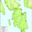
NGR NS 03763 64396
Datum OSGB36 - NGR
Permalink http://canmore.org.uk/site/40442


- Council Argyll And Bute
- Parish North Bute
- Former Region Strathclyde
- Former District Argyll And Bute
- Former County Buteshire
NS06SW 9 03763 64396.
(NS 0375 6438) Watch Hill (NR).
OS 6" map (1957)
'The Watch Hill on Upper Ardroscadale was, on excavation a few years ago, found to be a grave-mound, composed of stones from the shore and earth, in the centre of which was a cist containing fragments of bones, and what seems to have been, from its description, the remains of a bronze sword.'
J K Hewison 1893
Watch Hill is a mound, c 40' in diameter by 4' high. The farmer of Upper Ardroscadale dug into it many years ago and found an implement, said to have been of bronze, and like a "sword blade". This has disappeared. The mound is now a rabbit warren and in the summer of 1903 what was described as a metal buckle, green in colour, was found at the mouth of one of the holes. This also has been lost. Excavations were carried through the mound, but nothing was found. The mound was of clayey soil with a few large stones.
T H Bryce 1904
A large round cairn. According to Dorothy Marshall it was plundered some time ago, but sufficient remains to be worth careful excavation at some future date. In the meantime it should be scheduled.
Information from K A Steer 15 July 1975
NS 0376 6489 Watch Hill (name verified) - A barrow situated on the crest of a slight ridge measures 12.2m E-W by 10.2m transversely and 1.1m high. It has a small quantity of modern field clearance strewn over it. There is no evidence of the cist mentioned by Hewison.
Surveyed at 1:10,000.
Visited by OS (TRG) 10 November 1976
This burial cairn stands in a cultivated field at the N end of a low ridge 250m WNW of Upper Ardroscadale farmsteading (NS06SW 33). It has extensive views in all directions except to the S, where the distant outlook is blocked by the main part of the ridge. The grass-grown cairn is largely as described by the Ordnance Survey in 1976; backfilled excavation trenches (probably Bryce’s) are clearly visible, but more recent disturbance to the SW flank of the mound may be nothing more than the result of trampling by cattle.
The cairn is depicted on the 1st edition of the OS 6-inch map (Argyllshire and Buteshire 1869, Sheet CCIII) and the contemporary Name Book (No.6, 49) notes, ‘Mr Stewart the farmer when digging the centre of it a few years ago found several small pieces of copper and an ivory headed Cain Stick. The copper were attached to pieces of decayed wood’ The Name Book also records that on an unspecified estate map the mound was referred to as ’the Watch Hill’.
Visited by RCAHMS (GFG, JMH) 6 May 2009.
Field Visit (1863)
Reference (1893)
'The Watch Hill on Upper Ardroscadale was, on excavation a few years ago, found to be a grave-mound, composed of stones from the shore and earth, in the centre of which was a cist containing fragments of bones, and what seems to have been, from its description, the remains of a bronze sword.'
J K Hewison 1893
Excavation (31 August 1972)
(NS 0375 6438) Watch Hill (NR).
OS 6" map (1957)
Watch Hill is a mound, c 40' in diameter by 4' high. The farmer of Upper Ardroscadale dug into it many years ago and found an implement, said to have been of bronze, and like a "sword blade". This has disappeared. The mound is now a rabbit warren and in the summer of 1903 what was described as a metal buckle, green in colour, was found at the mouth of one of the holes. This also has been lost. Excavations were carried through the mound, but nothing was found. The mound was of clayey soil with a few large stones (Bryce 1904).
Hewison, presuambly referring to the farmer's excavations above, states that a cist, containing fragments of bones and what seems to have been a bronze sword was found in the centre of Watch Hill.
Information from OS (IF) 31 August 1972
Field Visit (15 July 1975)
A large round cairn. According to Dorothy Marshall it was plundered some time ago, but sufficient remains to be worth careful excavation at some future date. In the meantime it should be scheduled.
Information from K A Steer 15 July 1975
Field Visit (10 November 1976)
NS 0376 6489 Watch Hill (name verified) - A barrow situated on the crest of a slight ridge measures 12.2m E-W by 10.2m transversely and 1.1m high. It has a small quantity of modern field clearance strewn over it. There is no evidence of the cist mentioned by Hewison.
Surveyed at 1:10,000.
Visited by OS (TRG) 10 November 1976
Reference (1980)
Field Visit (6 May 2009)
This burial cairn stands in a cultivated field at the N end of a low ridge 250m WNW of Upper Ardroscadale farmsteading (NS06SW 33). It has extensive views in all directions except to the S, where the distant outlook is blocked by the main part of the ridge. The grass-grown cairn is largely as described by the Ordnance Survey in 1976; backfilled excavation trenches (probably Bryce’s) are clearly visible, but more recent disturbance to the SW flank of the mound may be nothing more than the result of trampling by cattle.
The cairn is depicted on the 1st edition of the OS 6-inch map (Argyllshire and Buteshire 1869, Sheet CCIII) and the contemporary Name Book (No.6, 49) notes, ‘Mr Stewart the farmer when digging the centre of it a few years ago found several small pieces of copper and an ivory headed Cain Stick. The copper were attached to pieces of decayed wood’ The Name Book also records that on an unspecified estate map the mound was referred to as ’the Watch Hill’.
Visited by RCAHMS (GFG, JMH) 6 May 2009.

