
Moss Farm, Arran


Cairnfield (Prehistoric)
Site Name Moss Farm, Arran
Classification Cairnfield (Prehistoric)
Alternative Name(s) Machrie Moor
Canmore ID 39740
Site Number NR93SW 42
NGR NR 90581 32269
NGR Description NR 9061 3232, NR 9062 3228 and NR 9058 3226
Datum OSGB36 - NGR
Permalink http://canmore.org.uk/site/39740


- Council North Ayrshire
- Parish Kilmory
- Former Region Strathclyde
- Former District Cunninghame
- Former County Buteshire
Field Visit (3 October 1977)
'A': NR 9060 3252. 'B': NR 9061 3228. 'C': NR 9057 3226.
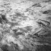
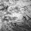
Three irregularly shaped mounds or cairns were identified.
'A' & 'B' correspond in general size and position with the above, but 'C' has no similarity in either respect; it measures 12.5m N-S by 11.0m E-W and is 1.3m high.
'A' and 'B' are both 1.0m high. Set in a pre-historic landscape with a suspected field wall and hut circles they are possibly clearance heaps. (see NR83SE 11).
Surveyed at 1:10 000.
Visited by OS (J R L) 3 October 1977.
Field Visit (17 September 1977)
NR93SW 42 9060 3252, 9061 3228 and 9057 3226
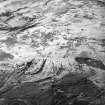
'A' NR 9060 3252. A circular heather-covered mound 8m long and 7m wide.
'B' NR 9061 3228. A flat-lying circular cairn 5m in diameter.
'C' NR 9057 3226. A heather-covered circular mound lying flat 6m in diameter.
Probing revealed stone in each mound.
Information from DoE Arran field survey (1976), nos. 36 (3, 6, 7).
NMRS, MS/861/13.
Note (23 July 2018 - 24 July 2018)
The location, classification and period of this site have been reviewed.
HES Survey and Recording 23-24 July 2018.

