
Arrn, Moss Farm


Hut Circle (Prehistoric)
Site Name Arrn, Moss Farm
Classification Hut Circle (Prehistoric)
Alternative Name(s) Machrie Moor; A
Canmore ID 39709
Site Number NR93SW 14
NGR NR 9067 3218
NGR Description NR 9067 3218 and 9077 3219
Datum OSGB36 - NGR
Permalink http://canmore.org.uk/site/39709


- Council North Ayrshire
- Parish Kilmory
- Former Region Strathclyde
- Former District Cunninghame
- Former County Buteshire
Desk Based Assessment (14 September 1977)
NR93SW 14 9067 3218 and 9077 3219.
(NR 9067 32176 'A' and NR 9077 3217 'B') Hut Circles (NR)
OS 6" map, (1924)
A hut circle, now heather-covered, approximately 9.0m diameter. Information from DoE field survey (1976), no. 37 (10).
Source: NMRS, MS/861/13.
Field Visit (16 September 1977)
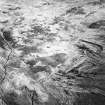
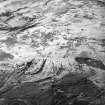
'A' NR 9067 3218 [west]. A probable hut circle, peat and heather covered, occupying a slight W-facing rise at c. 100 ft OD. An earthen bank 4m wide on the N side, 2m wide on the S and 0.9m external height, encloses a featureless dished interior approx. 9m overall diameter and 1.3m maximum depth. Several large stones protrude through the peat cover around the internal rim of the bank, which has a 1.6m wide entrance on the E side.
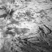
'B' NR 9077 3219 [east]. A probable hut circle, peat and heather covered, occupying the top of a slight hillock at 100 ft OD. A circular bank 3.0m wide and 0.7m high encloses a level featureless interior of 9.0m overall diameter. The bank, which has no surface stone, has an unusual entrance 2.5m wide on the E side. Projecting from the N side of the break is a short curving return bank, of similar proportions, forming a staggered 'double' entrance to the whole. There is no apparent field system.
Surveyed at 1:10 000.
Visited by OS (J R L) 16 September 1977.
Note (23 July 2018 - 24 July 2018)
The location, classification and period of this site have been reviewed.
HES Survey and Recording 23-24 July 2018.

