
Arran, Moss Farm


Hut Circle (Prehistoric)
Site Name Arran, Moss Farm
Classification Hut Circle (Prehistoric)
Alternative Name(s) Machrie Moor
Canmore ID 39708
Site Number NR93SW 13
NGR NR 90514 32287
Datum OSGB36 - NGR
Permalink http://canmore.org.uk/site/39708


- Council North Ayrshire
- Parish Kilmory
- Former Region Strathclyde
- Former District Cunninghame
- Former County Buteshire
Desk Based Assessment (16 September 1977)
NR93SW 13 9050 3228.
(NR 9048 3229) Hut Circle (NR)
OS 6" map, Buteshire, (1924)
A circular bank of approx 9.0m internal diameter inside a sub-rectangular bank measuring 13.0m by 19.0m.
Information from DoE Arran field survey (1976), no. 36 (5).
Source: NMRS, MS/861/13.
Field Visit (28 September 1977)
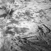
NR 9050 3228. These features ocupy a slight hillcrest on undulating moorland at 100ft OD and are under peat and heather. Little evidence of stone was found by probing.
A horse-shoe shaped bank up to 5.0m wide and 0.8m external height, encloses a dished featureless interior 10.0m E-W by 7.0m N-S and 1.0m maximum depth. There is a 4.0m wide break on the E side.
On the E and S sides of this feature is a curving, less substantial, enclosure bank measuring 2.0m wide and 0.5m high. It extends to the W and then turns sharply N for 12.0m before fading.
The enclosure has similarities with a nearby hut circle (NR93SW 14'A') although its purpose is not obvious.
Surveyed at 1:10 000.
Visited by OS (J R L) 28 September 1977.
Note (23 July 2018 - 24 July 2018)
The location, classification and period of this site have been reviewed.
HES Survey and Recording 23-24 July 2018.

