|
Photographs and Off-line Digital Images |
B 32606 |
|
Urn from cist (fig.58) in J A Balfour, 1910, 'The Book of Arran', p.118 |
1910 |
Item Level |
|
|
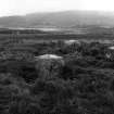
Photographs and Off-line Digital Images |
BU 412 PO |
|
View looking NE. |
1978 |
Item Level |
|
|
Prints and Drawings |
BUD 27/1 |
Records of the Society of Antiquaries of Scotland, Edinburgh, Scotland |
No. 5 Drawing J.Skene 1832 Filed SAS 464 |
1832 |
Item Level |
|
|
Prints and Drawings |
BUD 27/2 |
Records of the Society of Antiquaries of Scotland, Edinburgh, Scotland |
Drawing showing monuments at Machrie Moor, Arran in 1832. |
1832 |
Item Level |
|
|
Prints and Drawings |
DC 21163 CO |
|
Plane table survey - circle 4 |
1970 |
Item Level |
|
|
Prints and Drawings |
DC 31478 |
|
Tracing of Bryce diagram from 1861 excavations. Stone circle No.4 |
|
Item Level |
|
 |
On-line Digital Images |
SC 336633 |
Records of the Ordnance Survey, Southampton, Hampshire, England |
View of stone circle from south west. |
13/9/1977 |
Item Level |
|
|
Photographs and Off-line Digital Images |
D 5695 |
RCAHMS Aerial Photography |
Machrie Moor and Moss Farm, oblique aerial view, centred on stone circle 5. |
13/12/1996 |
Item Level |
|
|
Photographs and Off-line Digital Images |
D 5694 |
RCAHMS Aerial Photography |
Machrie Moor, oblique aerial view, centred on two stone circles. |
13/12/1996 |
Item Level |
|
|
Photographs and Off-line Digital Images |
D 5696 |
RCAHMS Aerial Photography |
Machrie Moor, oblique aerial view. |
13/12/1996 |
Item Level |
|
|
Photographs and Off-line Digital Images |
D 5697 |
RCAHMS Aerial Photography |
Machrie Moor, oblique aerial view, centred on three stone circles. |
13/12/1996 |
Item Level |
|
|
Photographs and Off-line Digital Images |
D 5700 |
RCAHMS Aerial Photography |
Machrie Moor, oblique aerial view, centred on three stone circles. |
13/12/1996 |
Item Level |
|
|
Photographs and Off-line Digital Images |
D 5712 |
RCAHMS Aerial Photography |
Machrie Moor and Moss Farm, oblique aerial view, with the stone circles in the top half of the photograph and a hut-circle and possible hut-circle in the bottom half. |
13/12/1996 |
Item Level |
|
|
Photographs and Off-line Digital Images |
C 74989 CN |
RCAHMS Aerial Photography |
Machrie Moor, oblique aerial view, centred on a group of stone circles. |
13/12/1996 |
Item Level |
|
|
Photographs and Off-line Digital Images |
C 74990 CN |
RCAHMS Aerial Photography |
Machrie Moor, oblique aerial view. |
13/12/1996 |
Item Level |
|
|
Photographs and Off-line Digital Images |
C 74991 CN |
RCAHMS Aerial Photography |
Machrie Moor, oblique aerial view, centred on three stone circles. |
13/12/1996 |
Item Level |
|
|
Photographs and Off-line Digital Images |
C 74992 CN |
RCAHMS Aerial Photography |
Machrie Moor, oblique aerial view, centred on stone circle 5. |
13/12/1996 |
Item Level |
|
|
Photographs and Off-line Digital Images |
C 74993 CN |
RCAHMS Aerial Photography |
Machrie Moor, oblique aerial view, centred on three stone circles. |
13/12/1996 |
Item Level |
|
|
Photographs and Off-line Digital Images |
C 74994 CN |
RCAHMS Aerial Photography |
Machrie Moor, oblique aerial view, centred on stone circle 5. |
13/12/1996 |
Item Level |
|
|
Photographs and Off-line Digital Images |
C 74995 CN |
RCAHMS Aerial Photography |
Machrie Moor, oblique aerial view, centred on two stone circles. |
13/12/1996 |
Item Level |
|
|
Photographs and Off-line Digital Images |
D 86007 CS |
RCAHMS Aerial Photography |
Machrie Moor, oblique aerial view. |
13/12/1996 |
Item Level |
|
|
Photographs and Off-line Digital Images |
D 86008 CS |
RCAHMS Aerial Photography |
Machrie Moor, oblique aerial view. |
13/12/1996 |
Item Level |
|
|
Photographs and Off-line Digital Images |
D 86011 CS |
RCAHMS Aerial Photography |
Machrie Moor, oblique aerial view. |
13/12/1996 |
Item Level |
|
|
Photographs and Off-line Digital Images |
D 86012 CS |
RCAHMS Aerial Photography |
Machrie Moor, oblique aerial view. |
13/12/1996 |
Item Level |
|


