
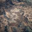
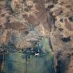
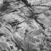
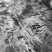
Arran, Machrie Moor 3


Stone Circle (Neolithic) - (Bronze Age)
Site Name Arran, Machrie Moor 3
Classification Stone Circle (Neolithic) - (Bronze Age)
Canmore ID 39700
Site Number NR93SW 1.01
NGR NR 91006 32457
Datum OSGB36 - NGR
Permalink http://canmore.org.uk/site/39700


- Council North Ayrshire
- Parish Kilmory
- Former Region Strathclyde
- Former District Cunninghame
- Former County Buteshire
NR93SW 1.01 91006 32457
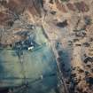
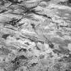
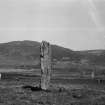
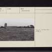
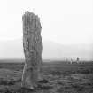
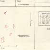
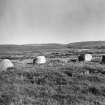
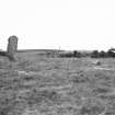
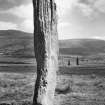
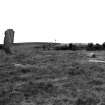
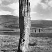
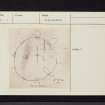
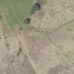
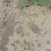
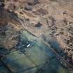
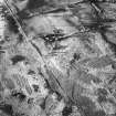
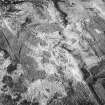
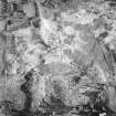
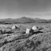
A: at NR 9102 3244. Of the nine stones forming this circle, only one still stands, some 4.3m high; the stumps of three others still show. The snapped-off upper parts of these are still there under the peat. The remainder of the stones were located by probing in 1963. They form the same geometrical egg-shape as the outer ring of circle NR93SW 10. The axis of symmetry (NE-SW) is 15.56m long (stone 10 may be part of stone 3).
Excavations by Bryce in 1861 uncovered a short cist in the centre containing an "urn" with some flint flakes. The "urn", which contained fragments of burnt bone, disintegrated on removal. A second cist was found 3 ft S of the centre; it contained a crouched burial, also with some flint flakes.
The finds were donated to the National Museum of Antiquities of Scotland (NMAS) in 1863 by the Duke of Hamilton.
Information from OS (IF) 28 June 1977.
Sources: A Roy, N McGrail and R Carmichael 1963; J Bryce 1863; E W MacKie 1975; Proc Soc Antiq Scot 1865
NR 9101 3245. The remains of this stone circle are generally as described above. There are now however only eight stones visible; one lies within the circle, one just outside and the other six form the circumference. It is not possible to deduce the exact shape of this 'circle' from the stones that remain on the surface.
Surveyed at 1:10 000.
Visited by OS (BS) 13 September 1977.
Note (23 July 2018 - 24 July 2018)
The location, classification and period of this site have been reviewed.
HES Survey and Recording 23-24 July 2018.

