
Dun Fhuarlit


Kerb Cairn (Prehistoric)
Site Name Dun Fhuarlit
Classification Kerb Cairn (Prehistoric)
Alternative Name(s) Ardnaw, Kilmory2
Canmore ID 38638
Site Number NR67NE 2
NGR NR 6987 7504
Datum OSGB36 - NGR
Permalink http://canmore.org.uk/site/38638


- Council Argyll And Bute
- Parish South Knapdale
- Former Region Strathclyde
- Former District Argyll And Bute
- Former County Argyll
NR67NE 2 6987 7504.
(NR 6987 7503) Dun Fhuarlit (NR) Fort (NR)
OS 6" map (1924)
A rough mound of loose stones, traditionally a fort.
Name Book 1868
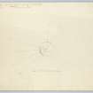
This cairn is situated on a small rounded knoll. The surrounding ground has been under cultivation at one time, but has reverted to rough grazing, and the footings of a small building and of ruined stone and turf walls are nearby. A considerable quantity of the cairn material has been robbed, probably to build the structures just mentioned. The circualr cairn is 65' in diameter and stands 6' high. A continuous stretch of the original kerb, 34' long, may be seen on SW, and three single kerbstones survive on the S, with two on the N. There is no visible trace of a cist or other internal structure.
RCAHMS MSS, visited 1959; M Campbell and M Sandeman 1964
Dun Fhuarlit, a cairn as described by the RCAHMS. A modern marker cairn occupies its centre.
Visited by OS (DWR) 5 June 1973
Field Visit (22 September 1942)
This site was included within the RCAHMS Emergency Survey (1942-3), an unpublished rescue project. Site descriptions, organised by county, vary from short notes to lengthy and full descriptions and are available to view online with contemporary sketches and photographs. The original typescripts, manuscripts, notebooks and photographs can also be consulted in the RCAHMS Search Room.
Information from RCAHMS (GFG) 10 December 2014.
Field Visit (8 May 1959)
This site was surveyed as part of the early work for the Argyll Inventories.
Field Visit (May 1983)
A cairn, known as Dun Fuarlit, occupies the summit of a rocky knoll 300m WSW of Ardnaw (Name Book 1868; Campbell and Sandeman 1964); it has a diameter of about 19m and an average height of 1.5m, and several stretches of kebstones remain in position, particularly round the S arc. A modern marker-cairn has been erected on it.
Visited May 1983
RCAHMS 1988

