
Islay, Kilslevan


Burial Ground (Early Medieval) - (Medieval), Chapel (Early Medieval) - (Medieval)
Site Name Islay, Kilslevan
Classification Burial Ground (Early Medieval) - (Medieval), Chapel (Early Medieval) - (Medieval)
Alternative Name(s) Cill Sleabhan
Canmore ID 38122
Site Number NR46NW 3
NGR NR 4218 6733
Datum OSGB36 - NGR
Permalink http://canmore.org.uk/site/38122


- Council Argyll And Bute
- Parish Killarow And Kilmeny
- Former Region Strathclyde
- Former District Argyll And Bute
- Former County Argyll
NR46NW 3 4218 6733.
(NR 4220 6733) Cill Sleabhan (NR) Chapel (NR) (In Ruins)
OS 6" map, Argyllshire, 2nd ed., (1900)
Cill Sleabhan: This name applies to an ancient burial ground, with the ruins of a chapel at its centre (ONB 1878).
Name Book 1878; W D Lamont 1972.
Watson, spelling the Gaelic name 'Cill Sleibheainn', states that it commemorates Slebhine, abbot of Hi, who died in 767.
W J Watson 1926
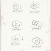
The scanty remains of this chapel stand on the margins open moorland about 2 km SW of Port Askaig. The building
whose walls now stand to a maximum height of 0.8m appears to have measured about 6.3m from WSW to ENE
3.7m transversely within walls 1m in thickness, and the masonry seems to have been constructed without the use
lime mortar. A gap in the centre of the WSW wall indicates probable position of the entrance.
The chapel is tightly enclosed by a drystone wall of circular plan measuring about 2.4m in width at base and rising to a maximum height of 1m. Agap in the SE sector of the circuit marks the position of a former entrance, while a larger gap in the W sector appears to have been formed by the partial intrusion within the enclosure of a secondary building of
subrectangular plan; this measures about 4-5 m from NW to SE by 3m transversely within walls 0.7m in thickness. There are no visible gravestones.
Visited August 1975
RCAHMS 1984
A chapel and disused burial ground as described and planned. The north-west side of the burial ground is in the line of an old field bank. The chapel measures internally 6.2m ENE-WSW, by 3.5m; the wall, turf-covered, is about 1.0m thick and stands to 0.7m maximum. The burial ground, D-shaped but for the re-entrant angle in NW corner, measures 12.5 by 12.5m inside a turf- covered wall spread 2.5m broad and, 0.8m maximum height.
Surveyed at 1:10,000.
Visited by OS (J M) 1 April 1979.
Field Visit (August 1975)
NR 421 673. The scanty remains of this chapel stand on the margins open moorland about 2 km SW of Port Askaig. The building whose walls now stand to a maximum height of 0.8m appears to have measured about 6.3m from WSW to ENE 3.7m transversely within walls 1m in thickness, and the masonry seems to have been constructed without the use lime mortar. A gap in the centre of the WSW wall indicates probable position of the entrance.
The chapel is tightly enclosed by a drystone wall of circular plan measuring about 2.4m in width at base and rising to a maximum height of 1m. A gap in the SE sector of the circuit marks the position of a former entrance, while a larger gap in the W sector appears to have been formed by the partial intrusion within the enclosure of a secondary building of subrectangular plan; this measures about 4-5 m from NW to SE by 3m transversely within walls 0.7m in thickness. There are no visible gravestones.
Visited August 1975
RCAHMS 1984
Measured Survey (4 August 1975)
RCAHMS surveyed the chapel at Kilslevan in 1975 at 1:100. The drawing was reproduced in ink and published at a reduced scale (RCAHMS 1984, figs. 26E, 223B).

