
Islay, Nosebridge


Township (Period Unassigned)
Site Name Islay, Nosebridge
Classification Township (Period Unassigned)
Canmore ID 37730
Site Number NR36SE 19
NGR NR 3720 6020
NGR Description Centred on NR 3720 6020
Datum OSGB36 - NGR
Permalink http://canmore.org.uk/site/37730


- Council Argyll And Bute
- Parish Killarow And Kilmeny
- Former Region Strathclyde
- Former District Argyll And Bute
- Former County Argyll
NR36SE 19 centred on 3720 6020
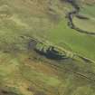
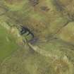
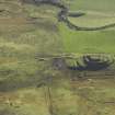
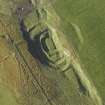
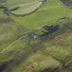
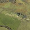
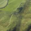
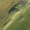
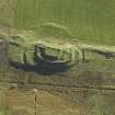
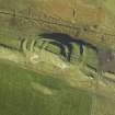
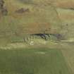
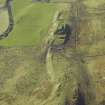
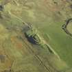
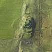
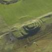
(Centred NR 3722 6020) Nosebridge: A district originally composed of small farms, now consisting of four distinct collections of ruins, spread for 3/4 mile along the NW bank of the River Laggan.
Name Book 1878
The former settlement of Nosebridge, deserted and reduced to turf-covered footings comprises nine rectangular buildings, seven small enclosures and associated cultivation.
Surveyed at 1:10 000.
Visited by OS (N K B) 29 June 1978
A manuscript annotation on an RCAHMS working map indicates 'Township remains seen to be of comparatively recent date'.
(Undated) information in NMRS
Ten unroofed buildings, one of which is a long building, and four enclosures are depicted on the OS 1st edition 6-inch map (Argyllshire 1881, sheet ccix). Seven unroofed buildings and six enclosures are shown on the current edition of the OS 1:10000 map (1981).
Information from RCAHMS (SAH) 16 November 1998

