Scheduled Maintenance
Please be advised that this website will undergo scheduled maintenance on the following dates: •
Tuesday 3rd December 11:00-15:00
During these times, some services may be temporarily unavailable. We apologise for any inconvenience this may cause.
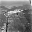
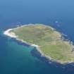
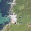
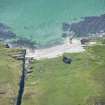
Nave Island
Building(S) (Medieval) - (Post Medieval), Burial Ground (Early Medieval) - (Medieval), Chapel (Medieval), Kelp Working Site (19th Century), Monastery (Early Medieval)(Possible)
Site Name Nave Island
Classification Building(S) (Medieval) - (Post Medieval), Burial Ground (Early Medieval) - (Medieval), Chapel (Medieval), Kelp Working Site (19th Century), Monastery (Early Medieval)(Possible)
Alternative Name(s) Kilnave
Canmore ID 37472
Site Number NR27NE 1
NGR NR 29201 75873
Datum OSGB36 - NGR
Permalink http://canmore.org.uk/site/37472
- Council Argyll And Bute
- Parish Kilchoman
- Former Region Strathclyde
- Former District Argyll And Bute
- Former County Argyll
NR27NE 1 29201 75873
For cross, see NR27NE 1.01.
(NR 2917 7587) Chapel (NR) (In ruins) Burial Ground (NR)
OS 6" map, Argyllshire, 2nd ed., (1881)
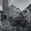
Generally believed to have been founded by a disciple of St. Columbus this chapel was disused and ruinous by 1785, in which year the walls were repaired, an addition was made on the south side and a tall chimney, still standing, was built in the NE corner of the ruins for the purpose of processing kelp. Beyond that it is very old, nothing is known of the previous history of the chapel. The burial ground adjoins the chapel on the west. A small rocky knoll to the north is named Carn a Mhanaich, Cairn of the Monk (NR 292 760).
Name Book 1878
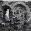
This chapel was almost entire until mutilated by the kelp-burners. Its internal length is about 22ft and its features resemble the Romanesque (ie. Norman). The only apertures are two windows with enormous semi-circular rear-arches in the east of the south wall, and a similar window together with a broken doorway in the north wall. Against the east end are traces of an altar with a projecting table on each side of it.
T S Muir 1885
The island name Eilean Neimh means 'Nein's Island', and presumably derives from one of the four saints of that name. (No dates given). The sanctuary has been deserted.
W J Watson 1926
Measured Survey (1974 - 1975)
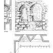
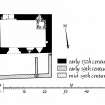
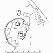
RCAHMS undertook measured survey at Nave Island between 1974 and 1975, producing a general plan (1:400), a phased plan of the chapel (1:100), and detailed drawings of the S window (1:20). The surveys drawings were redrawn in ink and published at reduced scales (RCAHMS 1984, figs. 33(B), 225B,226B, 227B).
Field Visit (15 June 1978)
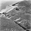
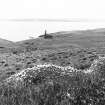
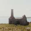
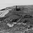
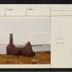
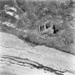
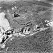
The ruins of the chapel as described by Muir survive to gable height; the 18th century brick-built chimney within it is virtually complete. Around the chapel on all but the seaward side is a curving retaining wall now turf-covered and tumbled, 1.0m. maximum height, which incorporates slabs of living rock in its course. It encloses an area about 45.0m. east-west by 33.0m. north-south, but it is interrupted by later rectangular building footings presumably associated with the 18th century kelp industry; further rectangular buildings and walls occur in the enclosed area.
This curving wall probably demarcates the burial ground, but no grave-slabs can be seen.
Local tradition asserts that a 'monastery' existed on Nave Island around the chapel, and this may be correct, the aforementioned wall delineating the boundary. Watson (1926) has indicated a Celtic foundation from place-names evidence and the nearby hill name Carn a Mhanaich, Cairn of the Monk is significant. The situation on a small off-shore island is typical of a Celtic Monastic site. No beehive cells can be identified, but the whole area is devastated by later structures, and without excavation the site cannot be classified with certainty.
Surveyed at 1:10 000.
Visited by OS (N K B) 15 June 1978
Field Visit (June 1981)
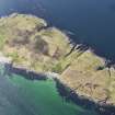
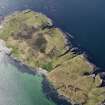
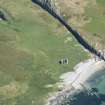
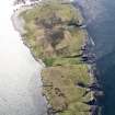
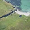
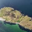
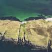
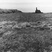
This medieval chapel is situated on the SE shore of Nave Island (c.42 ha), at the head of the sloping shingle beach of Port na h-Eaglaise which provides a convenient boat-landing opposite the mouth of Loch Gruinart. The dedication is unknown, and the chapel is first mentioned in 1549 by Monro (Munro 1884), but on architectural grounds it may be ascribed to the first half of the 13th century. The ovoid enclosure within which it stands, however, may be of Early Christian date, and although Skene's identification of the island with Elena Insula, mentioned as the site of a monastery by Adomnan in his Life of Columba, is speculative (Adamnan in Skene; Adoman, Anderson), the discovery of a cross-fragment of probable 5th-century date strengthens the possibility of a monastic origin. (on Nave Island, the discovery of part of a cross as similar date to that at Kildalton and Iona supports an Early Christian origin for the ovoid stone-walled enclosure round the medieval chapel, which is comparable in size and character with the inner enclosure on Eileach an Naoimh. RCAHMS 1984)
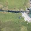
Some 45m NE of the chapel the island is traversed by Sloc na Maoile, a perpendicular-sided gully about 6m in average width, created by the erosion of a basalt dyke. An area of almost 2 ha is enclosed between this gully and a curving turf dyke which runs from the SW side of the chapel-enclosure to the head of a second gully on the NW shore. Within this large enclosure there are extensive remains of rig-cultivation. Nave Island, which along with the adjacent estate of Ardnave was a property of lona Abbey until the Reformation, was described by Monro in 1549 as inhabited and cultivated, and 18th-century estate-rentals refer to its agricultural value. (Exch. Rolls 13 (1508-1513), 219; Coll. de Rebus Alban., 3, 163, 171; Monro 1884, 60; Islay Bk., 89, 91, 476-7, 484, 507, 543). A number of buildings at the N side of the burial-ground were probably associated with this agrarian activity, but some may belong to the final phase of occupation, towards the middle of the 19th century, when a group of kelp-burners erected a furnace with a chimney some 8.5m in height in the NE angle of the chapel, and are said to have laid waste the burial-ground (Muir 1885, 16; Muir 1861, 128; Graham 1895, 49).
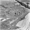
The site is sheltered on the W by rising ground, and although most of the burial-ground is level the enclosure-wall in the W sector takes the form of a revetment running just below the scarp. In this area the enclosure is subdivided by a wall, of uncertain age, at the foot of the slope. The original enclosure measured about 46m from N to S by 34m transversely, and its drystone wall is best preserved immediately SE of the chapel, where two courses of basalt blocks remain in the outer face and it has a maximum thickness of 2.6m. South of the chapel the course of the wall cannot be traced for some 20m, and it was interrupted by a rock outcrop whose N face is cut into by two probable quarry-pits. Above this outcrop, the wall can be traced from a point 18m SW of the chapel (fig. A, RCAHMS 1984), running NW as a turf-covered mound about 2m thick, with intermittent facing-stones. A turf dyke running SE from the same point towards the shore is probably of recent origin, and the dyke of the large enclosure described above also begins at this point. On the sloping ground in the W sector there are traces of a structure (B) about 3m square abutting the boundary-wall. In the NE sector the course of the wall is overlain by the remains of two subrectangular buildings (C, D). These, together with a similar building (E) and a larger and better-preserved one retaining two pairs of cruck-slots (F), both situated a few metres N of the enclosure, probably belong to the period of agrarian occupation described above. A building within the enclosure (G), which measures internally 6m from E to W by 4m transversely, differs from the others in having square internal angles, and may be of earlier date. To the S of building G, and some 9m NW of the chapel, there is a low rectangular platform (H), measuring about 3m by 2.2m, which is bounded by a kerb of basalt blocks and is covered with small stones including many white quartz pebbles. This platform may have marked a grave of special importance, or been a prayer-station of the type known in Ireland as a leacht (Thomas 1971, 58-64, 144, 168-75. Cf. RCAHMS 1984, 177, 179).
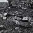
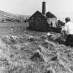
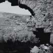
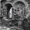
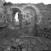
The chapel is built of local basalt rubble, much of it quarried in oblong blocks and neatly coursed with small pinnings. The furnace in the NE angle has a rubble base, while its chimney was built of small and poorly fired bricks. The entire building was heavily repointed during the 19th-century period of industrial use, and it appears to have been roofed with slate at that time. It measures 6.75m by 4.1m within walls 0.9m thick, and was entered by a doorway, of which only a few stones of the E jamb and part of the semicircular rear-arch survive, near the W end of the N wall. It was lit by a splayed N window, now blocked by the furnace, and by a two-light window at the E end of the S wall, which is an interesting version, in local materials, of a type commonly executed, at Kildalton (RCAHMS 1984, No. 367) and elsewhere, in freestone.
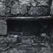
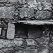
The junction of the splays was formed by regular blocks of basalt set obliquely, and the sloped sill of the E light, the only one not filled by later blocking, was carefully shaped to receive the jambs of the daylight-opening. The arch-heads, which were formed by thin rubble slab-voussoirs, appear to have been semicircular but are now incomolete. Towards the S end of the E wall there is an aurnbry, and above it a shelf formed by a thin slab which extends to the S wall, resembling a feature in a similar position on Eileach an Naoimh.
Outside the S wall of the chapel there was a rubble-built lean-to annexe some 3m in internal width. When first built its W end was open, and it may have served as a cart-shed, but following the insertion of a W wall faced externally with brick, the only access was by an opening broken through the S wall of the chapel. Probably at the same time, the annexe was subdivided by a partition-wall which blocked an earlier window in its S wall. These alterations were probably made at the period when the furnace was built, while the original construction of the annexe may belong to the first phase of industrial activity, or to the last period of agrarian use of the site.
With the exception of the cross-fragment described below, no carved stones are now identifiable in the burial-ground or reused as building-material, and the belief that the kelp-burners destroyed a number of late medieval effigies and graveslabs is probably based on a misapprehension. (Graham 1895, 49, quoting NSA, 7 (Argyll), 650, where the section beginning 'the gravestones...' probably applied to the whole parish of Kilchoman, rather than to Nave Island alone.)
Cross:
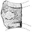
A fragment of the arm of a free-standing cross, probably of 5th-century date, was identified among the rough paving on the floor of the chapel during the present survey and is now in the Museum of Islay Life, Port Charlotte. Carved of local green schist and now heavily worn, it measures 0.46m by 0.33m by 38mm in incomplete thickness. Like the nearby cross at Kilnave (RCAHMS 1984, No. 374), it had a broad flat margin, measuring in this case 70mm, within which an ornamental motif was set on a background of knitted interlace. On the Nave Island fragment this motif was a lozenge within a rectangular panel whose spandrels contain ornament, possibly of foliaceous character, incorporating pellets. The measurement across the constriction of the arm, some 390mm, was almost 100mm greater than that of the Kilnave Cross, and the Nave Island carving may have been correspondingly higher than the latter.
RCAHMS 1984, visited June 1981
Measured Survey (1983)
RCAHMS prepared a measured drawing of the cross-fragment from Nave Island at 1:10 in 1983. The ink drawing was published at a reduced scale of 1:15 (RCAHMS 1984, 228A).
Desk Based Assessment (23 October 1998)
The ruined chapel, with the chimney in its NE corner and the adjoining building to the S, and three other unroofed buildings are depicted on the OS 1st edition 6-inch map (Argyllshire 1881, sheet clxxxvi). Three unroofed buildings, one of which is annotated as Chapel (remains of), one unroofed structure and some enclosure walls are shown on the current edition of the OS 1:10000 map (1981).
Information from RCAHMS (SAH) 23 October 1998
Note (7 April 1999)
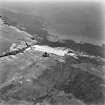
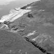
The aerial photographs (RCAHMSAP, 1977) AG 7524, 5, 6, 7 had been entered into the database under the site of Nave Island. These, however, are images of Ardnamurchan Lighthouse (NM46NW 4] and Branault, Croft House [NM56NW 3]. The images which relate to Nave Island and which presumably have similar negative numbers to the ones above have not been located at the time of the architecture catalogue upgrade - 7.4.1999.


