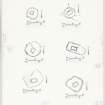
Islay, Cill Eathain
Chapel (Early Medieval) - (Medieval)
Site Name Islay, Cill Eathain
Classification Chapel (Early Medieval) - (Medieval)
Canmore ID 37278
Site Number NR24SE 1
NGR NR 28001 43372
Datum OSGB36 - NGR
Permalink http://canmore.org.uk/site/37278
- Council Argyll And Bute
- Parish Kildalton And Oa
- Former Region Strathclyde
- Former District Argyll And Bute
- Former County Argyll
NR24SE 1 2799 4337
(NR 2799 4337) Cill Eathain (NR)
OS 6" map (1900)
A piece of enclosed ground formerly used as a burial ground.
Name Book 1878
The ruin of a Medieval chapel measuring 14ft N-S by 10 1/2ft E-W lying within a roughly circular enclosure which measures about 65ft overall. Inside the enclosure and close to the west wall is an oval mound 14ft by 18ft. The chapel gives name to the adjoining lands of Killeyan, the earliest known spelling being 'Killaane' in 1541.
Information from W D Lamont letter, 2 October 1957.
The grass-covered remains of an alleged chapel and burial ground situated on a level stance on the south bank of the Abhainn Ghil. They comprise a rectangular structure 6.5m north-south by 5.0m over walling spread to 1.5m and surviving to a height of 0.4m within a sub-circular enclosure 20.0m across. The enclosure wall is 2.0m wide and up to 0.7m high on all but the north quadrant where there is a scarp 1.7m high.
The significance of an amorphous spread of stones just inside the north west corner of the enclosure cannot be determined.
Although the documentary evidence and local association of names point to this being a chapel and burial ground the north-south orientation is unusual and its walling appears to have been narrower than that of other chapels known on Islay.
Surveyed at 1:10 000.
Visited by OS (BS) 6 June 1978
Measured Survey (29 May 1976)
RCAHMS surveyed the chapel at Cill Eathain at a scale of 1:100. The plan was redrawn in ink and published at a reduced scale (RCAHMS 1984, fig. 26J), with a site plan including the enclosure reproduced at a smaller scale (fig. 165B).
Field Visit (March 1981)
NR 279 433. This chapel, which was evidently dedicated to St John (Watson 1926) is situated on a natural terrace some 30m S of the Abhainn Ghil, about 500m E of that stream's outfall into Loch Indaal and 360m NE of Lower Killeyan farmhouse.
The walls of the chapel are now represented by low turf-covered stony mounds enclosing an area about 5m from NE to SW by 3.5m transversely. A break towards the NE end of the SE wall appears to be of recent origin, and the position of the' original entrance is uncertain.
The building stands within a roughly circular enclosure about 19m in diameter, delimited to the NE by a natural scarp, and on the other sides by a turf-covered mound up to 0.8m in height and 1.4m in thickness, which incorporates occasional massive facing-stones. There are traces of a possible wall curving NW from the N angle of the chapel, which appears to have divided the lower area to the NE from the remainder of the enclosure, but this feature is obscured by a mound of stones, probably cleared from the surrounding land which shows evidence of rig-cultivation.
RCAHMS 1984, visited March 1981.


