
Following the launch of trove.scot in February 2025 we are now planning the retiral of some of our webservices. Canmore will be switched off on 24th June 2025. Information about the closure can be found on the HES website: Retiral of HES web services | Historic Environment Scotland
High Banks 3


Cup And Ring Marked Rock (Neolithic) - (Bronze Age)
Site Name High Banks 3
Classification Cup And Ring Marked Rock (Neolithic) - (Bronze Age)
Canmore ID 368534
Site Number NX74NW 182
NGR NX 70911 48963
Datum OSGB36 - NGR
Permalink http://canmore.org.uk/site/368534


- Council Dumfries And Galloway
- Parish Kirkcudbright
- Former Region Dumfries And Galloway
- Former District Stewartry
- Former County Kirkcudbrightshire
Note (19 October 2018)
Date Fieldwork Started: 19/10/2018
Compiled by: ScRAP
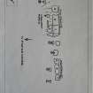
Location Notes: The panel is located in an undulating field of improved pasture on the NW side of a low ridge of outcropping rock running SW-NE. There are further areas of carvings on the same outcrop to the NE and SW of High Banks 3 which are recorded here as High Banks 1-6, and there may well be more carvings beneath the turf. Overall, the carvings occur over a 30m length of the outcrop. The outcrop has been quarried extensively on its NW side, and an interpretation panel has been placed in the quarried area. The field is uphill and SE of High Banks Farm where the is carparking and a sign to the rock art. There is a small forestry plantation about 50m to the SW and a marshy area 150m to the SSE. There are extensive views to the coast and hills to the W, to Cairnsmore of Corsharn to the NW and Bengairn to the N.There are also other outcrops in the same field and adjacent fields - some with known carvings and others that may well have carvings on them. This panel is grouped with High Banks 1-6 under Canmore 64442 but is separated from the other panels by several metres of turf and is situated about 6m WNW of High Banks 4, on the sloping NW shoulder of the low knoll. It forms part of the Scheduled Monument number 1028. High Banks 3 was originally recorded as part of High Banks 1c by Morris and High Banks B1 and B3 by van Hoek.
Panel Notes: This is an oblong area of exposed bedrock measuring about 1.3 x 1.1m with a maximum height of 0.5m, and flush with the ground elsewhere. The surface slopes at about 20 degrees to the NW in line with the slope of the land. A wide turf-filled fissure runs width-wise across the E edge of the panel. The panel is dominated by a roughly central large cup with 5 rings and a radial from the outer ring running to the edge of the panel. 3 of the rings may be penannular. This motif is partially encircled by 22 cups, at least 2 of which have short radials running to the edge of the panel. This carved surface is connected to another area of carved outcrop to the E with 3 (possibly 4) cups, one with a short curved radial. The area to the E of this is carved with 16 cups, 1 with a possible partial ring. 8 of these cups form a tight cluster on the edge of the panel, and some have been scored through by a sharp implement, possibly a plough.

