
Scurdie Ness, Montroseness Lighthouse


Lighthouse (19th Century)
Site Name Scurdie Ness, Montroseness Lighthouse
Classification Lighthouse (19th Century)
Alternative Name(s) Scurdie Ness Lighthouse; Scurdieness Lighthouse; Montrose Harbour Approach
Canmore ID 36262
Site Number NO75NW 48
NGR NO 73322 56758
Datum OSGB36 - NGR
Permalink http://canmore.org.uk/site/36262


- Council Angus
- Parish Craig
- Former Region Tayside
- Former District Angus
- Former County Angus
NO75NW 48 73322 56758
Montroseness Lighthouse [NAT]
OS 1:10,000 map, 1984.
See also NO75NW 57 and NO75NW 58.
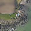
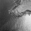
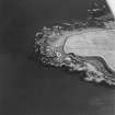
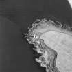
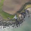
(Location cited as NO 733 568). Scurdie Ness Lighthouse, built 1870 and beacons (NO 727 568 and 731 568), 18th century. The beacons [for which see NO75NW 57 and NO75NW 58] are conical rubble structures, that at NO 731 568 being the taller.
J R Hume 1977.
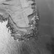
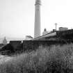
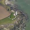
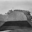
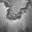
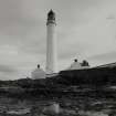
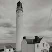
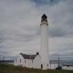
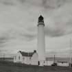
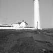
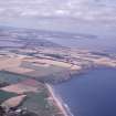
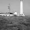
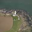
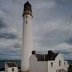
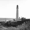
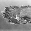
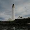
Scurdie Ness lighthouse guards and defines the entrance to Montrose harbour from a position near the tip of the promontory of the same name, which projects markedly into the North Sea on the south side of the mouth of the combined rivers North and South Esk. It was built by engineers D and T Stevenson as part of the programme instigated following the Baillie Hamilton report, and was first lit in 1870. It was temporarily repainted in black during the second world war, and was automated in 1987.
Information from RCAHMS (RJCM), 28 July 2000.
R W Munro 1979; K Allardyce 1998.
Montroseness Lighthouse [NAT]
OS (GIS) MasterMap, 2011.
Note (28 July 2000)
Scurdie Ness lighthouse guards and defines the entrance to Montrose harbour from a position near the tip of the promontory of the same name, which projects markedly into the North Sea on the south side of the mouth of the combined rivers North and South Esk. It was built by engineers D and T Stevenson as part of the programme instigated following the Baillie Hamilton report, and was first lit in 1870. It was temporarily repainted in black during the second world war, and was automated in 1987.
Information from RCAHMS (RJCM), 28 July 2000.
Publication Account (2013)
Established by the Northern Lighthouse Board in 1870, engineer David and Thomas Stevenson. A white tower 39 metres tall containing 170 steps. The nominal range is 23 nautical miles. The Light flashes every 20 seconds and was automated in 1987.
There are two day mark beacons directing shipping to the appropriate channel.
M Watson, 2013

