
Cairn O' Mount


Cairn (Prehistoric)
Site Name Cairn O' Mount
Classification Cairn (Prehistoric)
Alternative Name(s) Cairn O'mounth
Canmore ID 36154
Site Number NO68SW 3
NGR NO 64929 80686
Datum OSGB36 - NGR
Permalink http://canmore.org.uk/site/36154


- Council Aberdeenshire
- Parish Fordoun
- Former Region Grampian
- Former District Kincardine And Deeside
- Former County Kincardineshire
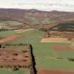
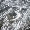
(Location cited as NO 6491 8068: GRC/AAS air and ground photographs listed). Altitude: 450m OD.
NMRS, MS/712/19.
Air photographs: AAS/94/08/G18/7-8.
NMRS, MS/712/21.
Field Visit (December 1981)
Cairn o' Mount 1 NO 649 806 NO68SW 3
This cairn is situated to the S of the summit of the Cairn o' Mount pass and 35m SW of the B974. It measures 15.5m in diameter by 3.5m in height and is surmounted by an OS triangulation cairn.
RCAHMS 1982, visited December 1981
Publication Account (1986)
This fine hilltop cairn is 15.5m in diameter and 3.5m high. It is typical of several skyline cairns which have been added to and altered by generations of travellers.
Information from ‘Exploring Scotland’s Heritage: Grampian’, (1986).
Publication Account (1996)
This fine hilltop cairn is 15.5m in diameter and 3.5m high. It is typical of several sky line cairns which have been added to and altered by generations of travellers. Another, much-reduced, example can be seen at the roadside c 50m to the ESE.
Information from ‘Exploring Scotland’s Heritage: Aberdeen and North-East Scotland’, (1996).

