
Bridge Wood, Bridge Of Dye


Farm Building (Modern), Road Bridge (17th Century), Smithy (Modern), Wash House (Modern), Watermill (Modern)
Site Name Bridge Wood, Bridge Of Dye
Classification Farm Building (Modern), Road Bridge (17th Century), Smithy (Modern), Wash House (Modern), Watermill (Modern)
Alternative Name(s) Water Of Dye
Canmore ID 36146
Site Number NO68NE 7
NGR NO 65107 86079
Datum OSGB36 - NGR
Permalink http://canmore.org.uk/site/36146


First 100 images shown. See the Collections panel (below) for a link to all digital images.
- Council Aberdeenshire
- Parish Strachan
- Former Region Grampian
- Former District Kincardine And Deeside
- Former County Kincardineshire
NO68NE 7 65107 86079
For adjacent pillboxes, see NO68NE 9.
Bridge of Dye [NAT]
OS (GIS) AIB, May 2006.
Built about 1680.
G M Fraser 1931.
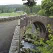
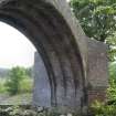
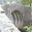
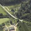
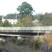
(Location cited as NO 652 861). Bridge of Dye, built 1680. A most attractive small single-span bridge, with a four-ribbed arch of 70ft (21.3m) span.
J R Hume 1977.
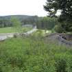
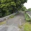
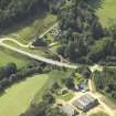
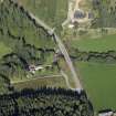
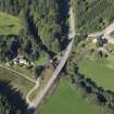
This bridge carries the B974 (Cairn o' Mounth) public road over the Water of Dye, in Glen Dye.
Information from RCAHMS (RJCM), 17 October 1997.
Photographic Survey (June 1963)
Photographic survey by the Scottish National Buildings Record/Ministry of Work in June 1963.
Publication Account (1986)
In a pre-improvement landscape where roads were scarcely cart tracks and hill roads, such as that ascending the Cairn o'Mount between the old town of Kincardine (now gone) and Strachan on the Feugh, merely hill paths, the Bridge of Dye must have been a welcome and imposing sight.
Built in 1680 with a ribbed single arch that harks back to late medieval times, this is one of the earliest bridges in the north-east. Its importance, and that of the north-south routeway on which it stands, are emphasized by an act of1681 that permitted tolls to belevied for its upkeep.
Information from ‘Exploring Scotland’s Heritage: Grampian’, (1986).
Publication Account (1996)
In a pre-improvement landscape where roads were scarcely cart tracks and hill roads, such as that ascending the Cairn o'Mount between the old town of Kincardine (now gone) and Strachan on the Feugh, merely hill paths, the Bridge of Dye must have been a welcome and imposing sight.
Built in 1680 with a ribbed single arch thar harks back to late medieval times, this is one of the earliest bridges in the North-east. Its importance, and that of the north-south routeway on which it stands, are emphasized by an act of 1681 that permitted tolls to be levied for its upkeep.
Information from ‘Exploring Scotland’s Heritage: Aberdeen and North-East Scotland’, (1996).
Publication Account (2007)
Bridge of Dye, Glendye
The Bridge of Dye, built in ca.1680, crosses the Water of Dye with a single semicircular arch of 43 ft span. The bridge, the second oldest on Deeside, was an important improvement on the line of the Cairn o’ Mount section of the old military road between Edinburgh and Fochabers. It has recently been bypassed by a new bridge alongside carrying the B974 road.
The arch is constructed of roughly dressed masonry and, in the manner of the Bridge of Dee at Aberdeen, is supported on stone ribs, in this case by four ribs spaced 212 ft apart. The roadway is 11 ft 8 in. wide between parapets.
R Paxton and J Shipway, 2007.
Reproduced from 'Civil Engineering heritage: Scotland - Highlands and Islands' with kind permission from Thomas Telford Publishers.
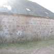
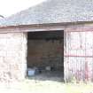
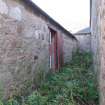
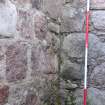
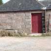
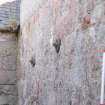
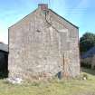
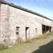
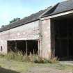
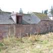
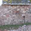
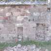
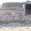
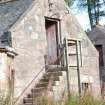
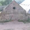
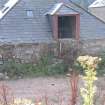
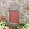
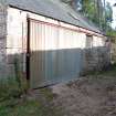
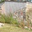
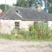
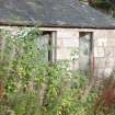
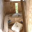
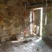
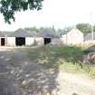
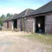
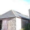
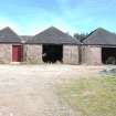
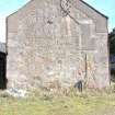
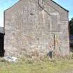
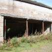
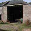
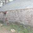
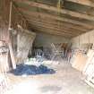
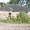
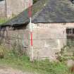
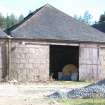
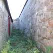
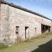
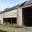
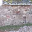
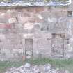
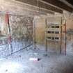
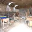
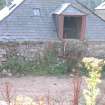
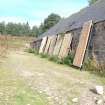
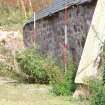
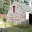
Standing Building Recording (17 September 2009)
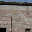
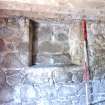
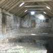
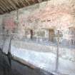
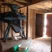
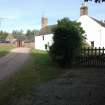
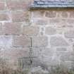
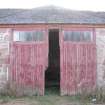
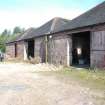
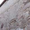
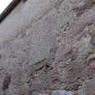
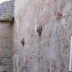
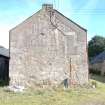
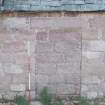
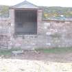
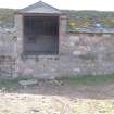
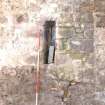
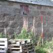
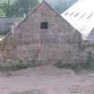
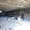
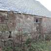
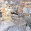
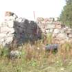
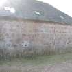
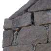
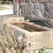
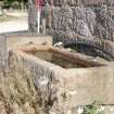
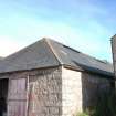
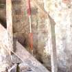
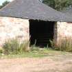
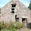
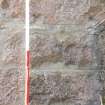
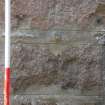
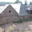
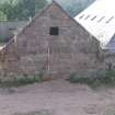
NO 6511 8608 A standing building recording of this well built estate farm steading was undertaken on 17 September 2009 prior to conversion. The main block comprised a large quadrangular steading of mid-19th-century date around an open yard. In the early 20th century the S range was removed and the yard in-filled with extra cattle accommodation. The N range had some surviving evidence of a former mill and threshing barn. The E range retained cart bays and farm workers’ accommodation. There is a second freestanding cattle byre of mid-19th-century date and a late 19th- to early 20th-century smithy with the forge and bellows in situ. A
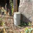
small mid-19th-century building is interpreted as a washhouse with a circular hearth below traces of a hanging lum. A large cast iron pot made in the Carron ironworks and c550mm in diameter with a spout appears to have been a boiler used on the hearth.
Report: Aberdeenshire SMR and RCAHMS
Funder: Fasque and Glendye Estates
HK Murray – Murray Archaeological Services Ltd
Publication Account (2013)
Built in 1680, a 42ft 9” span humped arch on four ribs, now by-passed. The adjacent lodge, 1778 had a water-powered sawmill for bobbins and a smiddy for the Southesk, then Fasque, estates
M Watson, 2013

