|
Prints and Drawings |
DC 1678 |
|
Unfinished plan of burgh and neighbourhood. |
1983 |
Item Level |
|
 |
On-line Digital Images |
SC 2411311 |
Records of the Ordnance Survey, Southampton, Hampshire, England |
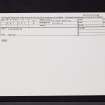
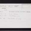
Kincardine, NO67SE 5, Ordnance Survey index card, Recto |
1958 |
Item Level |
|
 |
On-line Digital Images |
SC 2411312 |
Records of the Ordnance Survey, Southampton, Hampshire, England |
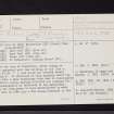
Kincardine, NO67SE 5, Ordnance Survey index card, page number 1, Recto |
1958 |
Item Level |
|
 |
On-line Digital Images |
SC 2411313 |
Records of the Ordnance Survey, Southampton, Hampshire, England |
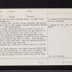
Kincardine, NO67SE 5, Ordnance Survey index card, page number 2, Verso |
1958 |
Item Level |
|
 |
On-line Digital Images |
SC 2411314 |
Records of the Ordnance Survey, Southampton, Hampshire, England |
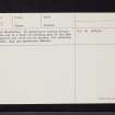
Kincardine, NO67SE 5, Ordnance Survey index card, page number 3, Recto |
1958 |
Item Level |
|
 |
On-line Digital Images |
SC 2411315 |
Records of the Ordnance Survey, Southampton, Hampshire, England |
Kincardine, NO67SE 5, Ordnance Survey index card, Recto |
1958 |
Item Level |
|
|
All Other |
551 166/1/1 |
Records of the Ordnance Survey, Southampton, Hampshire, England |
Archaeological site card index ('495' cards) |
1947 |
Sub-Group Level |
|


