
Pricing Change
New pricing for orders of material from this site will come into place shortly. Charges for supply of digital images, digitisation on demand, prints and licensing will be altered.
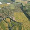
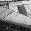
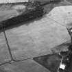
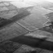
Boysack


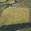
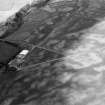
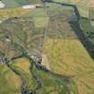
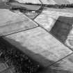
Rig And Furrow (Medieval) - (Post Medieval), Souterrain (Iron Age)(Possible), Unenclosed Settlement (Prehistoric)
Site Name Boysack
Classification Rig And Furrow (Medieval) - (Post Medieval), Souterrain (Iron Age)(Possible), Unenclosed Settlement (Prehistoric)
Canmore ID 35514
Site Number NO64NW 76
NGR NO 6223 4873
Datum OSGB36 - NGR
Permalink http://canmore.org.uk/site/35514


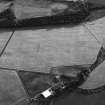


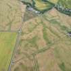
- Council Angus
- Parish Inverkeilor
- Former Region Tayside
- Former District Angus
- Former County Angus
Aerial Photographic Transcription (23 February 1992 - 6 March 1992)
An aerial transcription was produced from oblique aerial photographs. Information from Historic Environment Scotland (BM) 31 March 2017.

