
Balcathie


Four Poster Stone Circle (Bronze Age)(Possible), Pit(S) (Period Unassigned), Rig And Furrow (Medieval), Unenclosed Settlement (Period Unassigned)
Site Name Balcathie
Classification Four Poster Stone Circle (Bronze Age)(Possible), Pit(S) (Period Unassigned), Rig And Furrow (Medieval), Unenclosed Settlement (Period Unassigned)
Canmore ID 35378
Site Number NO63NW 3
NGR NO 606 391
Datum OSGB36 - NGR
Permalink http://canmore.org.uk/site/35378


- Council Angus
- Parish Arbirlot
- Former Region Tayside
- Former District Angus
- Former County Angus
NO63NW 3 606 391.
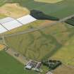
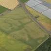
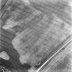
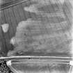
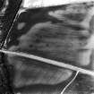
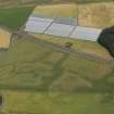
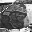
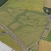
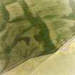
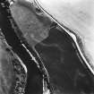
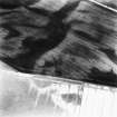
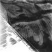
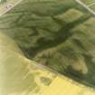
NO 606 391. Ring-ditches, Balcathie: visible on RCAHMS aerial photographs taken in 1979.
Aerial photography has recorded the cropmarks of several ring-ditches and pit features scattered across a field 250m W of Cotton of Balcathie. Probable settlement remains include at least three faint crescentic marks (probably houses) with further arcs of ditch and crescentic shapes representing some six further ring-ditches. Possible short double pit-alignments are visible at c.NO 6070 3921 and c.NO 6051 3914, each no more than 12m long. In the same field, cropmarks of further pit-defined features, souterrains and an enclosure (NO63NW 11) have been recorded.
Information from RCAHMS (KB) 12 April 1999

