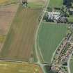
Accessibility

Font Size

100% 150% 200%

Background Colour

Default Contrast
Close Reset

Castle Mains

Field Boundary(S) (Period Unknown)

Site Name Castle Mains

Classification Field Boundary(S) (Period Unknown)

Canmore ID 349152

Site Number NT58SW 213

NGR NT 5190 8379

Datum OSGB36 - NGR

Permalink http://canmore.org.uk/site/349152

Ordnance Survey licence number AC0000807262. All rights reserved.
Canmore Disclaimer. © Copyright and database right 2024.

Toggle Aerial | View on large map

Digital Images

Collections

Administrative Areas

  • Council East Lothian
  • Parish Dirleton
  • Former Region Lothian
  • Former District East Lothian
  • Former County East Lothian

Activities

Aerial Photography (22 July 2014)

References

MyCanmore Image Contributions


Contribute an Image

MyCanmore Text Contributions