Pricing Change
New pricing for orders of material from this site will come into place shortly. Charges for supply of digital images, digitisation on demand, prints and licensing will be altered.
Finavon
Temporary Camp (Roman)
Site Name Finavon
Classification Temporary Camp (Roman)
Alternative Name(s) Finavon Bridge
Canmore ID 33677
Site Number NO45NE 21
NGR NO 4965 5745
NGR Description Centred NO 4965 5745
Datum OSGB36 - NGR
Permalink http://canmore.org.uk/site/33677
- Council Angus
- Parish Oathlaw
- Former Region Tayside
- Former District Angus
- Former County Angus
NO45NE 21 centred 4965 5745
The E ditch of this 37-acre (15 ha) camp was examined immediately south of the A49 road in advance of road-widening, and was found to be c.2m wide, flat-bottomed and 0.30m deep below ploughsoil 0.4m thick. At some period the ditch had been recut to a width of 0.8m and a depth of 0.30m. No trace of the SE gateway was found; this probably lies a little further north beneath the A49.
A trench at the SE corner of a rectangular enclosure lying 240-280m east of the camp revealed a ditch 1.60m wide and 0.15m deep.
S S Frere 1988.
Further excavation by CEU, in advance of A94 widening.
E Halpin 1987.
Aerial Photography (September 1970)
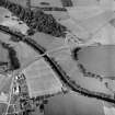
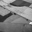
Oblique aerial photographs of Finavon Roman temporary camp and the cropmarks at Haughs of Finavon, taken by Mr John Dewar in 1970.
Note (1983)
Finavon, Temporary Camp NO 496 574 NO45NE 21
Situated on a level terrace on the left bank of the River South Esk immediately to the NE of Finavon Bridge, there is a temporary camp. Rectangular on plan, it measures about 420m from NW to SE by 360m transversely (c. 15ha). Two gates have been recorded, on the NE and SE respectively, both guarded by a titulum.
RCAHMS 1983.
(St Joseph 1973, 224).
Watching Brief (17 March 2009 - 23 June 2009)
During the period 17-18 March 2009 and again on 23 June 2009, SUAT Ltd carried out a watching brief (SUAT site code FF12) on groundworks for an extension to Peggy Scott's restaurant at Finavon, Angus centred on NGR NO 4959 5747. The development site was of archaeological interest because the restaurant and new extension is situated within the site of a c 15ha Roman temporary camp identified by aerial reconnaissance in 1962. Ground stripping and foundation cuts for the new build walls covered an area of 323.75m² on the NW side of the existing restaurant. Ground stripping to formation level did not require the complete removal of the subsoil deposits but deeper trenching for the construction of walls and pillars intruded into the natural fluvioglacial deposits. The ground works revealed topsoil/ploughsoil 0.40m in depth over subsoil 0.15m thick. Within the NW part of the new build site was a spread of lighter soil below the topsoil which contained occasional sherds of modern pottery. In the central area was a deposit of disturbed subsoil containing abundant modern pottery and glass. The area on the SE side was cut by a plastic drain in gravel and a yellow plastic domestic gas pipe. The 2 x 9m excavation for a septic tank in a field on the E side of the restaurant and the associated drain trench revealed topsoil/ploughsoil containing some fragments of ceramic field drain and modern pottery over subsoil to a combined depth of 0.37m. A plastic field drain crossed the septic tank excavation on a N-S line and an early modern field drain comprising field cobbles in a matrix of silt crossed the cut for the septic tank drain on a N-S line. No deposits or features that could be associated with the Roman temporary camp were identified.
Information from OASIS ID: suatltd1-61762 (SUAT Ltd), 2009
Publication Account (17 December 2011)
The camp at Finavon was first discovered through cropmarks from the air by St Joseph in 1962 (1965: 83), lying on a terrace to the north of the River South Esk, only 1km WSW of the camp at Marcus. It measures 435m from NNW to SSE by 370m transversely, enclosing an area of 16ha (39.5 acres). Entrance gaps are visible in the centre of the NNW and SSE sides, both protected by tituli. A further entrance gap is visible in the ENE side, south of the A90 road that crosses the camp. St Joseph carried out several excavations on the camp, publishing that the ditch was 1.4m wide and 0.8m deep (1965: 83, although his notebooks suggest a level of variation across the sections that he excavated – RCAHMS St Joseph Collection: Notebooks 3 & 4). Further trenching on the ENE side in 1987, in advance of road widening, recorded a shallow ditch, with one steep side and flat bottom (the other side had been truncated), measuring about 2m in width and 0.3m in depth. Later features cut through the ditch, including an almost V-shaped ditch, 0.8m wide and 0.3m deep. Both ditches were believed to have been deliberately backfilled (Halpin 1992: 173–5, 178–9).
R H Jones


