
Westfield


Enclosure (Prehistoric)
Site Name Westfield
Classification Enclosure (Prehistoric)
Canmore ID 33583
Site Number NO44NW 13
NGR NO 44277 49797
Datum OSGB36 - NGR
Permalink http://canmore.org.uk/site/33583


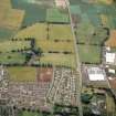

- Council Angus
- Parish Forfar
- Former Region Tayside
- Former District Angus
- Former County Angus
Note (1983)
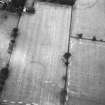
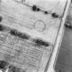
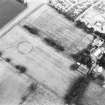
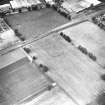
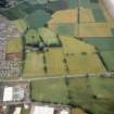
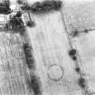
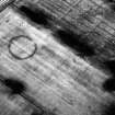
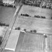
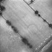
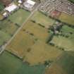
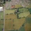
Westfield 2 NO 442 498 NO44NW
Cropmarks reveal a roughly circular enclosure 200m NW of Westfield farmhouse; it measures about 45m in diameter within a ditch 4m broad, and the entrance is on the ENE.
RCAHMS 1983.
Aerial Photographic Transcription (9 October 2017)
An interpretative transcription, or mapping, of information on oblique aerial photographs was produced on 9 October 2019.

