
Pricing Change
New pricing for orders of material from this site will come into place shortly. Charges for supply of digital images, digitisation on demand, prints and licensing will be altered.
Clarkly Hill


Settlement (Prehistoric)
Site Name Clarkly Hill
Classification Settlement (Prehistoric)
Canmore ID 332463
Site Number NJ16NW 127
NGR NJ 13071 67601
Datum OSGB36 - NGR
Permalink http://canmore.org.uk/site/332463


- Council Moray
- Parish Duffus
- Former Region Grampian
- Former District Moray
- Former County Morayshire
Excavation (24 July 2011 - 7 August 2011)
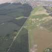
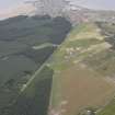
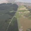
NJ 131 675 A geophysical survey by Tessa Poller of Glasgow University revealed a previously unknown later prehistoric settlement in an area where various stray finds had been made (NJ16NW 12). An excavation was carried out, 24 July–7 August 2011, to investigate and characterise the site. One trench confirmed the presence of a substantial ring ditch roundhouse with a complex subsequent history; two (perhaps originally three) orthostats were set up around its margin and a dark soil layer was deposited in which were found two steatite lamps, an iron knife and an iron dagger. Over this was a stone building platform associated with an extensive and well preserved cobbled spread. A cup-marked stone had been reused in the building platform. Other finds from this trench included a Romano-British trumpet brooch and a Roman Iron Age massive-style openwork finger ring.
An area with unclear geophysical signals proved to have a series of stone-founded structures with very shallow foundations. This included the robbed remains of a substantial stone slab floor with a hearth and an earlier vestigial sub-rectangular building with remains of a hearth, but with shallow stone foundations at one end only. These structures lay in an old soil layer which overlay a series of negative features, including ardmarks. Finds from the palaeosoil included a Guido class 8 yellow glass bead and an iron projecting ring-headed pin.
An area of very high remnant magnetism proved to be an industrial area towards the edge of the site. A small trench produced substantial quantities of iron-smelting slag and bog ore, a series of stone-built hearths, and heavily vitrified crucible sherds from non-ferrous metalworking.
Preservation is good (including bone survival) on account of the preserved ancient soils; post-medieval sand-blows over this area increased the soil depth, and modern agriculture has had a relatively limited impact.
Funder: National Museums Scotland, Society of Antiquaries of Scotland and Ian Keillar
National Museums Scotland, 2011
Excavation (1 July 2012 - 22 July 2012)
NJ 131 675 Work continued, 1–22 July 2012, on the extensive later prehistoric and early medieval settlement site at Clarkly Hill. The three trenches examined in 2011 were reopened (DES 2011, 124) and an additional trench was also excavated.
In Trench A an area of preserved old ploughsoil covered a series of stone structures. Further work revealed one of these was the stone foundations of a small rectangular building (c7 x 4m). To the NW this trench was expanded into Trench D, where the original find of Roman coins was concentrated. More coins were found scattered through the old ploughsoil, confirming that the hoard had been disturbed in antiquity. Cut into the natural was the post-ring of a roundhouse c10m in diameter. Over this was the erosion hollow from a small sub-oval building with a single structural post towards one end and remains of a wattle-lined wall. An adjacent amorphous scoop may be a further building. These fragile buildings are likely to be early medieval in date; further examples were recorded in Trench B, again overlying a roundhouse. Excavation here revealed more of the ring ditch house examined in 2011. Immediately after its abandonment a curving line of orthostats was constructed over it. Four stone settings were revealed in the excavated area. Only the stumps survived of two; the other two had been removed from their stoneholes. Both these holes were excavated, and produced evidence of deliberate deposits. In one, a human skull buried face down in the base of the pit, in the other a cache of artefacts including two reworked decorated sherds of Samian pottery, a silver finger ring and an iron knife. The nature of the original stones is unclear – it is tempting to speculate they may have been symbol stones. Dark soil formed around these stones, with a series of objects placed in it, apparently as offerings (see DES 2011, 124). Over this were more settlement remains: around the rectangular stone platform (5.6 x 4.4mm) excavated in 2011 were cobbled areas interpreted as the bases for turf walls. These defined oval buildings c4–6m across; a section of one revealed charcoal and ash rich deposits within them.
These trenches were all sealed by the remains of a ploughsoil which in turn was sealed by post-medieval sand-blow deposits and then partially truncated when the area was improved by digging through the sand in the 19th century. Trench E, to the W of the site, revealed much deeper deposits of ploughsoil, up to 1m thick, with the ditches between the rigs filled with wind-blown sand. The rigs were 5–6m wide. Trial trenching under this revealed a large ring ditch house indicated by geophysics. It was c18m across, with a single phase of postholes; evidence of support posts indicates repair. There was no hearth or cooking pit; finds (Roman glass, Iron Age bronze strap fitting, Guido type 13 glass bead) point to a Roman Iron Age date. The substantial ring ditch had stone slabs placed in its base. The house had been built up against an older (?Neolithic or Bronze Age?) standing stone, which was deliberately incorporated into its wall.
Trench C exposed more of the industrial area. The sequence was an extended one. At its base was a large pit which once held an iron-smelting furnace, the dismantled remains of which were found along with substantial amounts of iron slag and bog ore. Some of this had been used along with cobbles to form a wall along one edge of the pit. After the slag heap was levelled, a series of hearths was built, although no convincing associated structure was located. This was sealed by the old ploughsoil, which in turn was cut by a ditch. Finds included extensive slag, some crucible fragments from non-ferrous metalworking, a fragment of a steatite bowl, lots of cobble tools and rotary quern fragments.
Funder: Welsh Family Trust, Keillar family, Society of Antiquaries of Scotland, Association for Roman Archaeology, Cardiff University, Moray Field Club and National Museums Scotland
Fraser Hunter, National Museums Scotland
2012

