
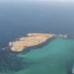
Papa Westray, Holm Of Papa Westray, North


Chambered Cairn (Neolithic), Inhumation(S) (Neolithic), Bead (Bone)(Neolithic), Unidentified Pottery (Pottery)(Neolithic)
Site Name Papa Westray, Holm Of Papa Westray, North
Classification Chambered Cairn (Neolithic), Inhumation(S) (Neolithic), Bead (Bone)(Neolithic), Unidentified Pottery (Pottery)(Neolithic)
Canmore ID 3243
Site Number HY55SW 2
NGR HY 50444 52277
Datum OSGB36 - NGR
Permalink http://canmore.org.uk/site/3243


- Council Orkney Islands
- Parish Papa Westray
- Former Region Orkney Islands Area
- Former District Orkney
- Former County Orkney
HY55SW 2 5044 5228.
(HY 5046 5229) Human Remains & Deer Horns found AD 1849 (NAT).
An Orkney-Cromarty-type stalled cairn opened in 1849, probably by Traill, and partially re-excavated by Petrie in 1854.(G Petrie 1859).
It has been heavily robbed, and only about 2' of cairn material remains, but it appears to measure about 40' NNW-SSE by 30' transversely, although the edge is very indefinite and partly obscured by later very ruinous constructions. (Information from Thos Traill, Holland).
A S Henshall 1963; Name Book 1879.
A chambered cairn at HY 5044 5228 (c.20.0m WSW of OS siting symbol) as described and planned by Henshall. Two mounds of uncertain date and purpose, each c.6.0m in diameter and 0.3m high, occur to the NE at distances of c.16.0m and 30.0m respectively. The former has an upright slab in its E arc, the latter an upright slab in its N side together with about 3.0m of an apparent inner wall face in the NW arc. Traces of other indeterminate structures occur in the area.
Surveyed at 1/2500.
Visited by OS(NKB) 1 July 1970.
Interim excavation report and radiocarbon dates:
Bone from primary context in tomb 2445 +- 60 bc GU-2067
Bone from primary context in tomb 2480 +- 60 bc GU-2068
Bone from fill of entrance passage 2120 +- 60 bc GU-2069
A Ritchie 1986.
Orkney Smr Note (June 1982)
There is a confusion of structures at the SW corner of the
tomb, and from the NW corner there is a distinct wall 0.4m wide
running off NW for 30m, its faces on both sides being defined by
earth-fast erect slabs. There may have been a similar wall going
off NE towards the two mounds described by OS. Mixed up in the
large stones of the adjacent storm beach are other structures
indicated by erect slabs and some apparent traces of laid masonry.
Information from Orkney SMR (RGL) June 82
Note (1983)
Holm of Papa Westray, North HY 5044 5227 HY55SW 2
First excavated in 1854, this Neolithic tomb, an Orkney-Cromarty stalled cairn, is currently being re-excavated (1982-3), revealing an oblong cairn, c.11m by 6m, with an inner and outer stone revetment, an entrance passage at the N end, and a rectangular burial-chamber. The chamber is 5.0m by 2.7m and is divided into four compartments by pairs of upright slabs; it contained a number of inhumation burials accompanied by plain pottery bowls, and a deposit of fish bones in a stone setting. The chamber had been deliberately infilled with earth, stones and food debris, including cattle, sheep, deer, shells
and fish bones. (A Ritchie)
RCAHMS 1983
(Petrie 1857, 62; Petrie Sketch Book no. 3 (in NMRS); RCAHMS 1946, ii, pp. 189-90, No. 545; Henshall 1963, 200-1; DES, 1982, 19).
Publication Account (1996)
This stalled cairn was excavated in the 1980s and, although largely filled in again as a protective measure, the main features of the tomb are still visible (the outer wall face was built up so that the original walling is safely beneath ground-level). The cairn is rectangular with a passage at the north end leading into a rectangular chamber, subdivided by upright slabs into four compartments. At the far end of the chamber is a small cell, which was apparently the first structure to be built and which was sealed off during the use of the main chamber. After it was sealed, a small stone box was constructed in the end-compartment, and this was found to be full of very small fish bones, perhaps reflecting some part of the ceremonies surrounding burial in the tomb. Fishing has always been part of the local economy, supplementing the fruits of the land. Bones from a small number of people remained in the tomb, both adults and children, and there was broken pottery and food refuse on the floor. After the final burial, the roof was removed and the entire tomb was filled with earth and stones. Traces of ancient field-walls and small cairns can be seen to the south and east of the tomb.
Information from ‘Exploring Scotland’s Heritage: Orkney’, (1996).
Field Visit (1998)
HY 5044 5228 (HPW1) - This stalled cairn had already been robbed of some of its stone prior to being 'explored' by Petrie in the late 1850s. When it was excavated in the 1982-3 several phases of construction were revealed (Ritchie,1996, Davidson & Henshall, 1989). The final phase of the cairn is rectangular in form, measuring 11m by 6m. It is aligned northwest-southeast with its entrance to the northwest. An entrance passage, 0.8m wide and 3m long leads into the chamber, 5m by 2.7m, which is divided into four parts. A cell to the rear of the cairn was found to have been filled up and sealed early in the use of the tomb. Human remains, representing eight or nine adults were recovered. Fragments of pottery, associated with the use of the tomb, along with animal and fish bone, stone tools, shell and worked bone were recovered. The site has been partially covered and is now somewhat overgrown.
HY 5045 5228 (HPW5) - A grassy mound, measuring 6m in diameter, stand up to 0.3m high. It lies 16m to the east of HPW1 and 5m to the west of HPW6. The frequent stones which protrude from the sides of the mound may be part of a chamber. It is located less than 20 m from the head of anencroaching storm beach.
HY 5046 5229 (HPW 6) - A very amorphous mound is defined to its southern side by a concentration of flat stones, possibly forming a kerb, which protrude through the turf. A second line of protruding slabs lies immediately behind this, while to the south and east there are the remnants of what may have been coursed walling. There are several depressed areas to the centre of the mound, one of which appears to have a stone lining and may be part of a badly damaged cist. Further upright slabs and stones protrude from the top of the mound but are obscured by a dense patch of nettles. The mound lies no further than 6m from the head of an encroaching storm beach which forms the northern tip of the Holm. Overall, it measures approximately 10m in diameter and stands to between 0.3m and 0.4m high.
Moore and Wilson, 1998
Orkney Coastal Zone Assessment
Environmental Sampling (2008)
HY 504 522 Fish remains were found in and around the Neolithic chambered tomb (ORK 21) and were recovered
by hand collection and coarse/fine sieving. Two discrete types of deposit were found, one derived from deliberate, anthropogenic fishing and other from otter spraint; both were found throughout the tomb with little evidence of spatial or chronological patterning.
Analysis has shown that people were fishing for cod family fish, including large cod and ling, as well as inshore,
coastal species like wrasse. Comparisons with contemporary assemblages suggest that this was typical of the period. The presence of large ling suggests deep-water fishing from boats at some distance from the shore. Small quantities of pierced vertebrae from ling and cod-family fish were found throughout the tomb and may have been worn as beads. Parallels from other Neolithic Orcadian sites are discussed in the full report, as are their potential symbolic meanings. A single cod vertebra had been butchered with a stone tool and is likely to represent the earliest evidence for fish butchery and processing in the Neolithic.
The fish remains may have been introduced to the tomb as grave goods, as feasting while interring or visiting the dead, or they may represent food consumed while building the tomb. The presence of otter spraint throughout this and other tombs suggests that otters were contemporary with the use of these tombs, and that they were probably accepted, or at least not discouraged, by humans.
Archive: RCAHMS (intended). Report: excavation report by A Ritchie (intended)
Funder: Society of Antiquaries of Scotland, Historic Scotland, The Binks Trust and The Robert Kiln Charitable Trust
Jennifer Harland and Rachel Parks (Fishlab, University of York), 2008

