
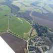
Knocknagel Farm


Farm (Period Unassigned), Pit (Period Unassigned)(Possible)
Site Name Knocknagel Farm
Classification Farm (Period Unassigned), Pit (Period Unassigned)(Possible)
Canmore ID 320610
Site Number NH64SE 567
NGR NH 65970 40815
Datum OSGB36 - NGR
Permalink http://canmore.org.uk/site/320610


- Council Highland
- Parish Inverness And Bona
- Former Region Highland
- Former District Inverness
- Former County Inverness-shire
Excavation (29 November 2011 - 2 December 2011)
A programme of archaeological works was carried out at Knocknagael Farm for the Bull Stud Modernisation Project. A photographic survey was undertaken of the existing standing buildings on the farmstead. A trial trenching evaluation covered 693m2 (7% of the available development area) revealed an isolated shallow pit c.0.68m in diameter and 0l.16m deep and filled with black silt containing several fire-cracked stones.
Information from Oasis (cfaarcha1-115474) 17 February 2012

