
Halls


Barrow (Prehistoric), Drain (Period Unassigned), Enclosure (Period Unassigned), Pit(S) (Period Unassigned), Roundhouse(S) (Prehistoric)
Site Name Halls
Classification Barrow (Prehistoric), Drain (Period Unassigned), Enclosure (Period Unassigned), Pit(S) (Period Unassigned), Roundhouse(S) (Prehistoric)
Canmore ID 313665
Site Number NT67SE 110
NGR NT 65425 72917
Datum OSGB36 - NGR
Permalink http://canmore.org.uk/site/313665


- Council East Lothian
- Parish Spott (East Lothian)
- Former Region Lothian
- Former District East Lothian
- Former County East Lothian
NT67SE 110 65425 72917
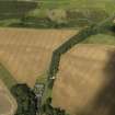
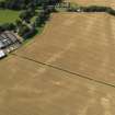
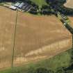
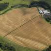
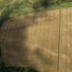
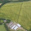
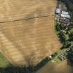
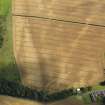
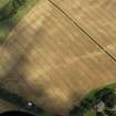
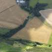
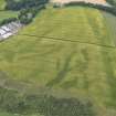
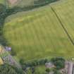
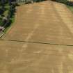
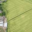
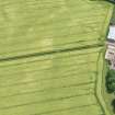
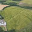
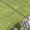
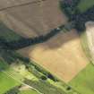
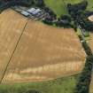
This enclosure and pits have been recorded as cropmarks on oblique aerial photographs (RCAHMSAP 2009). The enclosure is sub-rectangular in plan and defined by a ditch about 1.6m wide. The enclosed area is 23m NW-SE, and 8m SW-NE, but the E side is missing. Up to 20 pits are visible SE of the rectilinear enclosure, ranging from 2.5m to 7m in diameter. There is also modern drain traversing the field NW-SE.
Information from RCAHMS (KHJM) 31 Oct 2011
Aerial Photographic Transcription (31 October 2011)

