
North Cuil


Building (Period Unassigned)
Site Name North Cuil
Classification Building (Period Unassigned)
Canmore ID 309388
Site Number NM95NE 8.18
NGR NM 9745 5559
Datum OSGB36 - NGR
Permalink http://canmore.org.uk/site/309388


- Council Highland
- Parish Lismore And Appin (Lochaber)
- Former Region Highland
- Former District Lochaber
- Former County Argyll
Reference (1 May 2008 - 1 June 2008)
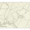
Old and more modern maps.
Field Visit (1 May 2008 - 1 June 2008)
Visual inspection of site: photographs: measured.
Surprisingly this building is not shown on maps such as Bedford's marine chart (1861) or the first (1875) or second (1897) editions of the OS 6-inch map (Argyllshire and Buteshire, sheet xliii). However, it is shown on the third edition (1976) as unroofed. It is probable that it was alredy ruinous by the time of Bedford's survey and was not noticed during what was, after all, a maritime one. Perhaps the Ordnance Survey relied too much on Bedford! It lies between a burn and a track and the Greenfield head dyke runs in a northerly direction from it. Apart from the seaward end which is about 60cms high only partial footings remain along with a lot of tumbled stone. There is still enough of the corners to show that these were rounded. To the front and back are small enclosures, the one at the front being bounded by a grassy stone dyke and the other by a turf dyke. Both are also bounded by the burn on their other side.

