
North Cuil


House (Period Unassigned)
Site Name North Cuil
Classification House (Period Unassigned)
Canmore ID 309214
Site Number NM95NE 8.07
NGR NM 9771 5535
Datum OSGB36 - NGR
Permalink http://canmore.org.uk/site/309214


- Council Highland
- Parish Lismore And Appin (Lochaber)
- Former Region Highland
- Former District Lochaber
- Former County Argyll
Reference (1 August 2008 - 1 September 2008)
Old maps and photographs.
Field Visit (1 August 2008 - 1 September 2008)
Walking the site: nothing left to measure!
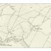
This house is shown as roofed on 1st edition of the OS 6-inch map (Argyllshire and Buteshire 1875, sheet xliii) map but unroofed on the second edition of 1897. It was photographed by Erskine Beveridge on 14th July 1883 and can be seen to be a small, drystone building with a thatched roof. Outside stand three children whose names I have been unable to determine. Their socks can be seen drying on a pole against the south-west wall. In the background the barn and byre dwelling at Greenfield farm can be seen. It is said that it was abandoned following a winter storm when the sea came into the house but no date is given. Now the site is a swamp and only a few stones can be detected. These were much more obvious 50 years ago.

