
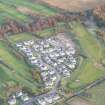
Slackbuie Way


Archaeological Feature(S) (Period Unassigned), Pit (Period Unassigned), Organic Material (Charcoal)
Site Name Slackbuie Way
Classification Archaeological Feature(S) (Period Unassigned), Pit (Period Unassigned), Organic Material (Charcoal)
Canmore ID 305344
Site Number NH64SE 558
NGR NH 675 422
Datum OSGB36 - NGR
Permalink http://canmore.org.uk/site/305344


- Council Highland
- Parish Inverness And Bona
- Former Region Highland
- Former District Inverness
- Former County Inverness-shire
Archaeological Evaluation (December 2006)
Centred on NH 673 418
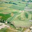
Inverness Property Development LPP commissioned Headland archaeology Ltd to undertake an archaeological evaluation in advance of a proposed development at Slackbuie, Inverness. Ninety-six trial trenches (totalling 3750 linear metres) were excavated in the proposed development area comprising an approximate 5% sample of the total. Two distinct areas contained evidence of significant archaeological remains. Area A (Field 3 - Trenches 10-13) in the northwest of the proposed development contained subcircular features interpreted as possible pits and post-holes and linear features. Finds from Area A comprised a single lithic tool recovered from a small circular feature suggesting that the assemblage is likely to date to the prehistoric period. Area B (Field 4 &6 – Trenches 38, 40, 48 & 49) located near the eastern boundary of the proposed development contained several sub-circular features, the most notable of which comprised a large post hole/pit, probably of early date given the similarity of this feature with post holes discovered as part of structures from the 1st and 2nd century AD remains from Culduthel Phase 5. Finds from Area B comprised two iron objects, slag and hammer scale from a small, truncated pit, indicating metalworking was being carried out in the locality. A possible prehistoric date has been suggested for these
features. Further isolated sub-circular features of unknown date and function were discovered in Trenches 30, 42, 43, 62 & 70. Although there was no evidence of rig and furrow, indicative of medieval and early
modern cultivation, two sherds of early modern pottery were recovered from the topsoil in Trench 46. This may indicate that the land was manured and cultivated during this period. Furthermore, the majority of trenches in Field 3-11 contained both rubble and ceramic field drains, suggesting that the site of the proposed development comprises improved farmland that has continued in use from the 18th century to the present day.
Headland Archaeology 2007
Archaeological Evaluation (29 June 2009 - 9 July 2009)
NH 675 422 (centred on) A 5% evaluation was undertaken 29 June–9 July 2009 prior to development. The work covered a linear route from Essich Road (NH 656 414) to Culduthel Road (NH 668 414) in the W and an area of land at Slackbuie in the E. A total of 40 trenches were opened, four of which revealed deposits of an archaeological nature.
Two features in one trench revealed evidence of burning. The first was an oval pit containing sub-angular stones and charcoal flecks. The second was a spread of grey silt containing charcoal and sub-rounded cobble inclusions. Two other trenches revealed two small isolated features containing charcoal fragments.
Archive: RCAHMS (intended). Report: HCAU and RCAHMS
Funder: Highland Council
Maureen Kilpatrick – GUARD

