
Wester Braikie, Farm


Farmhouse (Period Unassigned), Farmstead (Period Unassigned)
Site Name Wester Braikie, Farm
Classification Farmhouse (Period Unassigned), Farmstead (Period Unassigned)
Canmore ID 300344
Site Number NO65SW 60
NGR NO 62844 50955
NGR Description NO 62844 50955 and NO 62852 51003
Datum OSGB36 - NGR
Permalink http://canmore.org.uk/site/300344


- Council Angus
- Parish Kinnell
- Former Region Tayside
- Former District Angus
- Former County Angus
NO65SW 60 62844 50955 and 62852 51003
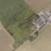
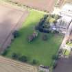
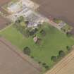
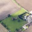
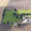
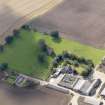
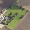
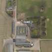
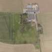
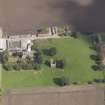
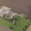
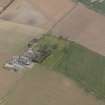
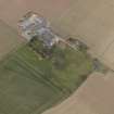
Identified from oblique aerial views (RCAHMSAP 2009), and situated immediately N of Braikie Castle/tower-house (NO65SW 20) is the farmhouse and farmstead of Wester Braikie. An L-shaped farmhouse with a roofed steading set around a courtyard with several buildings. The steading and house are in stone with slated roofes whilst the more recent structures are pre-fabricated.
Depicted as roofed on the 1st Edition of the OS 6-inch map (Forfarshire) and shown as a small house with the steading set around a courtyard.
Information from RCAHMS (DE), September 2009

