
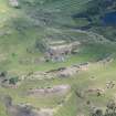
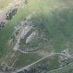
Thrummiecarr Heugh, Admiralty Distance Pole


Measured Mile Marker (20th Century)
Site Name Thrummiecarr Heugh, Admiralty Distance Pole
Classification Measured Mile Marker (20th Century)
Alternative Name(s) Measured Mile Marker
Canmore ID 299095
Site Number NT96NW 192
NGR NT 90002 68749
Datum OSGB36 - NGR
Permalink http://canmore.org.uk/site/299095


- Council Scottish Borders, The
- Parish Coldingham
- Former Region Borders
- Former District Berwickshire
- Former County Berwickshire
NT96NW 192 90002 68749
See also NT86NE 76, NT86NE 77 and NT96NW 193.

