 |
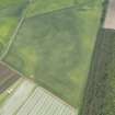
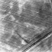
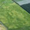
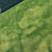
On-line Digital Images |
DP 162496 |
RCAHMS Aerial Photography Digital |
Oblique aerial view of the cropmarks of the ring ditch and rig at Rossie Drain, looking NW. |
26/6/2013 |
Item Level |
|
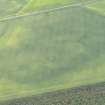 |
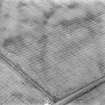
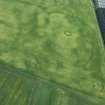
On-line Digital Images |
DP 162498 |
RCAHMS Aerial Photography Digital |
Oblique aerial view of the cropmarks of the ring ditch and rig at Rossie Drain, looking SW. |
26/6/2013 |
Item Level |
|
 |
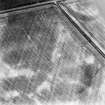
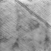
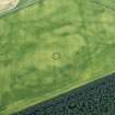
On-line Digital Images |
SC 1711383 |
RCAHMS Aerial Photography |
Rossie Drain: aerial view of cropmarks. |
19/7/1994 |
Item Level |
|
 |
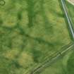
On-line Digital Images |
SC 1711384 |
RCAHMS Aerial Photography |
Rossie Drain: aerial view of cropmarks. |
19/7/1994 |
Item Level |
|
 |
On-line Digital Images |
SC 1711385 |
RCAHMS Aerial Photography |
Rossie Drain: aerial view of cropmarks. |
19/7/1994 |
Item Level |
|
 |
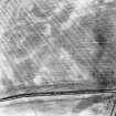
On-line Digital Images |
SC 1711464 |
RCAHMS Aerial Photography |
Oblique aerial view. |
1977 |
Item Level |
|
 |
On-line Digital Images |
SC 1711465 |
RCAHMS Aerial Photography |
Oblique aerial view. |
1977 |
Item Level |
|
 |
On-line Digital Images |
SC 2399843 |
Records of the Ordnance Survey, Southampton, Hampshire, England |
Rossie Drain, NO20NE 85, Ordnance Survey index card, Recto |
1958 |
Item Level |
|
 |
On-line Digital Images |
DP 407306 |
Historic Environment Scotland |
Oblique Aerial View |
20/6/2023 |
Item Level |
|
 |
On-line Digital Images |
DP 407307 |
Historic Environment Scotland |
Oblique Aerial View |
20/6/2023 |
Item Level |
|
 |
On-line Digital Images |
DP 407308 |
Historic Environment Scotland |
Oblique Aerial View |
20/6/2023 |
Item Level |
|
 |
On-line Digital Images |
DP 407310 |
Historic Environment Scotland |
Oblique Aerial View |
20/6/2023 |
Item Level |
|
 |
On-line Digital Images |
DP 407311 |
Historic Environment Scotland |
Oblique Aerial View |
20/6/2023 |
Item Level |
|


