
Chanonry Point


Building(S) (Period Unassigned)
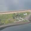
Site Name Chanonry Point
Classification Building(S) (Period Unassigned)
Canmore ID 294693
Site Number NH75NW 339
NGR NH 7489 5572
NGR Description Centred NH 7489 5572
Datum OSGB36 - NGR
Permalink http://canmore.org.uk/site/294693


- Council Highland
- Parish Rosemarkie
- Former Region Highland
- Former District Ross And Cromarty
- Former County Ross And Cromarty
NH75NW 339 centered on 7489 5572
NH 7489 5573 - building
NH 7489 5571 - building
Various roofed buildings on the 1st edition of the OS 6-inch map (Ross and Cromarty, sheet xc; 1881) - not located.
(coordinates given in MS 2776/1/4 are incorrect).
CFA/MORA Coastal Assessment Survey 1998.

