
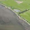
Belleport Pier, Cromarty Firth


Fishery (Period Unassigned), Fishing Stand (Period Unassigned), Stake Net
Site Name Belleport Pier, Cromarty Firth
Classification Fishery (Period Unassigned), Fishing Stand (Period Unassigned), Stake Net
Canmore ID 289560
Site Number NH66NE 135
NGR NH 6776 6886
Datum OSGB36 - NGR
Permalink http://canmore.org.uk/site/289560


- Council Highland
- Parish Rosskeen
- Former Region Highland
- Former District Ross And Cromarty
- Former County Ross And Cromarty
NH66NE 135 6765 6885
(NH 6755 6885) Fishing Stance.
A small mound of apparently quarried (i.e. angular) cobbles c. 2.5m diameter and at or near Low Water Mark standing 0.3m high.
CFA/MORA Coastal Assessment Survey 1998.

