
Bridge Of Isla


Road Bridge (18th Century) (1794)
Site Name Bridge Of Isla
Classification Road Bridge (18th Century) (1794)
Alternative Name(s) River Isla
Canmore ID 28535
Site Number NO13NE 66
NGR NO 16358 38159
Datum OSGB36 - NGR
Permalink http://canmore.org.uk/site/28535


- Council Perth And Kinross
- Parish Cargill
- Former Region Tayside
- Former District Perth And Kinross
- Former County Perthshire
NO13NE 66 16372 38142
For possible predecessor bridge (adjacent to W), see NO13NE 6.
Large bridge of five round arches with cutwaters. Central inscriptions: 'Founded June 4th 1794'; 'Finished August 18 1796'.
SDD 1962.
(Location cited as NO 163 382). Bridge of Isla, completed 1796. A very handsome five-span bridge with segmental arches. The voussoirs are dressed, and the spandrels rubble. There are triangular cutwaters.
J R Hume 1977.
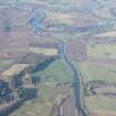
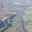
This bridge carries the A93 public road over the River Isla, which here forms the boundary between the parishes of Cargill and Caputh.
Information from RCAHMS (RJCM), 2 March 1998.

