Accessibility

Font Size

100% 150% 200%

Background Colour

Default Contrast
Close Reset


Due to scheduled maintenance work by our external provider, background aerial imagery on Canmore may be unavailable

between 12:00 Friday 15th December and 12:00 Monday 18th December


Allt Glas

Hut Circle (Prehistoric)(Possible)

Site Name Allt Glas

Classification Hut Circle (Prehistoric)(Possible)

Canmore ID 282351

Site Number NG88SW 21

NGR NG 82376 83041

Datum OSGB36 - NGR

Permalink http://canmore.org.uk/site/282351

Ordnance Survey licence number AC0000807262. All rights reserved.
Canmore Disclaimer. © Copyright and database right 2023.

Toggle Aerial | View on large map

Digital Images

Collections

Administrative Areas

  • Council Highland
  • Parish Gairloch
  • Former Region Highland
  • Former District Ross And Cromarty
  • Former County Ross And Cromarty

Archaeology Notes

NG88SW 20 82376 83041

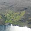
A probable hut circle sited on prominent knoll has a stone perimeter and measures 8m in diameter.

Information by email from Terry Doe, 20 March 2006

References

MyCanmore Image Contributions


Contribute an Image

MyCanmore Text Contributions