
Musselburgh, Eskgreen, Footbridge


Footbridge (20th Century)
Site Name Musselburgh, Eskgreen, Footbridge
Classification Footbridge (20th Century)
Alternative Name(s) River Esk; Electricity Bridge
Canmore ID 280769
Site Number NT37SW 1163
NGR NT 34382 72776
Datum OSGB36 - NGR
Permalink http://canmore.org.uk/site/280769

- Council East Lothian
- Parish Inveresk (East Lothian)
- Former Region Lothian
- Former District East Lothian
- Former County Midlothian
NT37SW 1163 34382 72776
Footbridge [NAT]
OS (GIS) AIB, April 2006.
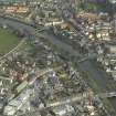
This weir spans the River Esk upstream from the weir NT37SW 1160, and below the town of Musselburgh (NT37SW 409). It apparently extends from NT c. 34351 72789 to NT c. 34411 72764.
Information from RCAHMS (RJCM), 26 April 2006.
As recorded by air photography (Cartographical Services A7 7062, flown 15 May 1992), this bridge is apparently the Electricity Bridge, which was built by Fairhurst and Partners in 1963. It is of steel, with a concrete deck.
Information from RCAHMS (RJCM), 3 May 2006.
J Gifford 1978.

