 |
On-line Digital Images |
DP 024641 |
RCAHMS Aerial Photography Digital |
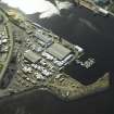
Oblique aerial view of the harbour centred on the breakwater, beacon and quay, taken from the NNE. |
3/4/2007 |
Item Level |
|
 |
On-line Digital Images |
DP 024643 |
RCAHMS Aerial Photography Digital |
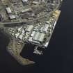
Oblique aerial view of the harbour centred on the breakwater, beacon and quay, taken from the NW. |
3/4/2007 |
Item Level |
|
 |
On-line Digital Images |
DP 024645 |
RCAHMS Aerial Photography Digital |
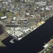
Oblique aerial view of the harbour centred on the breakwater, beacon and quay, taken from the WNW. |
3/4/2007 |
Item Level |
|
 |
On-line Digital Images |
DP 024647 |
RCAHMS Aerial Photography Digital |
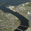
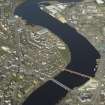
General oblique aerial view centred on the railway viaduct and shipyard with the harbour and road bridge adjacent, taken from the SSW. |
3/4/2007 |
Item Level |
|
 |
On-line Digital Images |
DP 024648 |
RCAHMS Aerial Photography Digital |
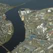
General oblique aerial view centred on the railway viaduct and shipyard with the harbour and road bridge adjacent, taken from the S. |
3/4/2007 |
Item Level |
|
 |
On-line Digital Images |
DP 024649 |
RCAHMS Aerial Photography Digital |
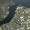
General oblique aerial view centred on the shipyard and harbour, taken from the SE. |
3/4/2007 |
Item Level |
|
 |
On-line Digital Images |
DP 024650 |
RCAHMS Aerial Photography Digital |
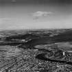
General oblique aerial view centred on the shipyard and harbour, taken from the ESE. |
3/4/2007 |
Item Level |
|
 |
On-line Digital Images |
SC 1315150 |
Records of Aerofilms Ltd, aerial photographers, Bristol, England |
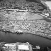
Inverness and Moray Firth, general view. Oblique aerial photograph taken facing north. This image has been produced from a print. |
12/10/1948 |
Item Level |
|
 |
On-line Digital Images |
SC 1676065 |
RCAHMS Aerial Photography |
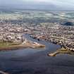
General oblique aerial view of the town, centred on the quays and brewery, taken from the NE. |
18/7/2001 |
Item Level |
|
 |
On-line Digital Images |
SC 1863180 |
Papers of James Sloan Bone, landscape historian, Inverness, Highland, Scotland |
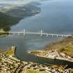
Aerial view of Inverness and River Ness, looking S. |
1988 |
Item Level |
|
 |
On-line Digital Images |
SC 1864934 |
Papers of James Sloan Bone, landscape historian, Inverness, Highland, Scotland |
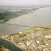
Aerial view of Kessock Bridge, Inverness, looking NE. |
1992 |
Item Level |
|
 |
On-line Digital Images |
SC 1865170 |
Papers of James Sloan Bone, landscape historian, Inverness, Highland, Scotland |
An oblique aerial view of Kessock Bridge, Inverness,, looking NNE. |
1995 |
Item Level |
|
 |
On-line Digital Images |
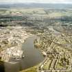
SC 1867253 |
Papers of James Sloan Bone, landscape historian, Inverness, Highland, Scotland |
Aerial view of Inverness, looking SE. |
1997 |
Item Level |
|
 |
On-line Digital Images |
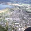
SC 1967353 |
Papers of James Sloan Bone, landscape historian, Inverness, Highland, Scotland |
Aerial view of Longman Industrial Estate, Inverness, looking ESE. |
9/1991 |
Item Level |
|
 |
On-line Digital Images |
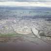
SC 1967531 |
Papers of James Sloan Bone, landscape historian, Inverness, Highland, Scotland |
Aerial view of Longman Harbour and mouth of the Caledonian Canal at Clachnaharry, Inverness, looking SE. |
7/1997 |
Item Level |
|
 |
On-line Digital Images |
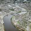
SC 1967533 |
Papers of James Sloan Bone, landscape historian, Inverness, Highland, Scotland |
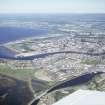
Aerial view of Longman Harbour and bridges over the River Ness, Inverness, looking SSE. |
7/1997 |
Item Level |
|
 |
On-line Digital Images |
SC 1967540 |
Papers of James Sloan Bone, landscape historian, Inverness, Highland, Scotland |
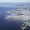
Aerial view of Caledonian Canal and mouth of River Ness at Muirtown, Inverness, looking SE. |
7/1997 |
Item Level |
|
 |
On-line Digital Images |
SC 1967543 |
Papers of James Sloan Bone, landscape historian, Inverness, Highland, Scotland |
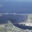
Aerial view of mouth of Caledonian Canal and River Ness with Kessock Bridge, Inverness, looking ESE. |
7/1997 |
Item Level |
|
 |
On-line Digital Images |
SC 1967545 |
Papers of James Sloan Bone, landscape historian, Inverness, Highland, Scotland |
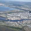
Aerial view of mouth of the River Ness and the Kessock Bridge, Inverness, looking NE. |
7/1997 |
Item Level |
|
 |
On-line Digital Images |
SC 1967600 |
Papers of James Sloan Bone, landscape historian, Inverness, Highland, Scotland |
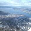
Aerial view of mouth of River Ness and Inverness Harbour, looking SE. |
8/2003 |
Item Level |
|
 |
On-line Digital Images |
SC 1967661 |
Papers of James Sloan Bone, landscape historian, Inverness, Highland, Scotland |
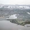
Aerial view of Inverness and the Beauly Firth, looking WNW. |
3/2005 |
Item Level |
|
 |
On-line Digital Images |
SC 1967736 |
Papers of James Sloan Bone, landscape historian, Inverness, Highland, Scotland |
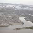
Aerial view of South Kessock, and Inverness Harbour, Inverness, looking SSE. |
4/2009 |
Item Level |
|
 |
On-line Digital Images |
SC 1967737 |
Papers of James Sloan Bone, landscape historian, Inverness, Highland, Scotland |
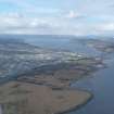
Aerial view of mouth of the River Ness and Inverness Harbour, looking SSE. |
4/2009 |
Item Level |
|
 |
On-line Digital Images |
DP 342963 |
Papers of James Sloan Bone, landscape historian, Inverness, Highland, Scotland |
Distant aerial view of Inverness and the Kessock Bridge, looking NW. |
20/3/2013 |
Item Level |
|


