Pricing Change
New pricing for orders of material from this site will come into place shortly. Charges for supply of digital images, digitisation on demand, prints and licensing will be altered.
Lui Water
Kiln (Post Medieval), Township (Post Medieval)
Site Name Lui Water
Classification Kiln (Post Medieval), Township (Post Medieval)
Alternative Name(s) Mar Lodge Estate; Glen Lui; Achavadie; Wester Auchavrie; Ach A' Mdadaidh; Derry Lodge
Canmore ID 27760
Site Number NO09SE 4
NGR NO 0520 9250
Datum OSGB36 - NGR
Permalink http://canmore.org.uk/site/27760
- Council Aberdeenshire
- Parish Crathie And Braemar
- Former Region Grampian
- Former District Kincardine And Deeside
- Former County Aberdeenshire
Observation (1987)
Turf and walled enclosures with inside a rectangular structure 8m by 4m and longhouse 14m by 5m. An L-plan assemblage of longhouse 10m by 5m, and longhouse 8m by 5m, with a third longhouse 10m by 5m. Upslope and set back from the inbye, a solitary sheal. Below the bluff on the edge of the 'greens', a semi-circular kiln 5m in diameter.
J S Smith 1987.
Field Visit (24 June 1993)
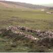
This township stands on a spur above the left bank of the Lui Water. It consists of at least eight buildings, a kiln, an enclosure and areas of rig cultivation, all lying within a head dyke which runs parallel to, and just below, the modern track through Glen Lui.
The buildings range in length from 6.9m to 9.1m and in breadth from 2.1m to 3.4m within faced-rubble walls measuring between 0.7m and 0.9m in thickness. Apart from one building (MAR93 63), whose walls are reduced to stony banks, they all have rounded corners and in several cases the walls are embanked with turf. One building (MAR93 59) is divided into two compartments, the E one featuring a drain. The layout of three buildings (MAR93 59-61) suggests a roughly planned courtyard, the E side of which is defined by a bank; otherwise the buildings have an informal arrangement. There is some evidence that the remains belong to different phases of construction: MAR93 63 is reduced to spread stony banks, suggesting that it may be earlier than the other buildings, MAR93 60 has been built over the N side of MAR93 61, and MAR93 57 appears to be an extension to MAR93 56.
The kiln (MAR93 64) is located to the W of the settlement at NO 0511 9252, set into the bottom of the slope at the rear edge of the haughland. Its oval bowl measures 1.8m by 1.6m within a wall 1.2m thick and there is a flue measuring 0.4m in width on the SW. The large size of this structure and the absence of an attached barn suggests that this may have been constructed for lime burning.
To the SW of the kiln there are traces of rig cultivation which may be associated either with this township or the neighbouring settlement to the W (NO09SE 5). There are other traces of ridging to the SE of the main group of buildings, and to the S there is a subrectangular enclosure.
A map of the Forrest of Mar by John Farquharson, dated 1703 (National Library of Scotland), indicates three settlements in this area of Glen Lui, one of which may be this site. The township may be that depicted on Roy's map (Roy 1747-55) as Achavadie, which may be Ach a' Mdadaidh in gaelic (Watson and Allan 1984). The 18th century estate rentals list an Easter and Wester Auchavrie (Aberdeen University Library, MS 3175), of which this must be Easter if NO09SE 5 is Wester.
(MAR93 55-64)
Visited by RCAHMS (SDB) 24 June 1993.


