
Cochno Hill


Searchlight Battery (Second World War)
Site Name Cochno Hill
Classification Searchlight Battery (Second World War)
Alternative Name(s) Greenside Reservoir; Ops No 1940 C243 (Pko17b)
Canmore ID 277165
Site Number NS47SE 241
NGR NS 4806 7468
NGR Description NS 4806 7468, c.NS 4855 7467 and c. NS 4808 7480
Datum OSGB36 - NGR
Permalink http://canmore.org.uk/site/277165


- Council West Dunbartonshire
- Parish Old Kilpatrick (Clydebank)
- Former Region Strathclyde
- Former District Clydebank
- Former County Dunbartonshire
NS47SE 241 4806 7468, c.4855 7467 and c. 4808 7480
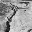
A civil small fire decoy and lighting decoy (QF and QL respectively), has been identified from vertical air photographs (CPE/Scot/265A Pt.1, 5017-5018, flown 14 August 1947), on the SE-facing slope of Cochno Hill and N of the Loch Humphrey Burn.
All that is visible on the photographs are three concrete hut bases immediately N of the track leading to Greenside Reservoir and a small enclosure some about 300m E. Two small structures which may possibly be related to the decoy are noted about 150m N of the hut bases.
Information from RCAHMS (DE, KM), November 2005
Field Visit (13 June 2018)
What has been erroneously identified as a decoy are the remains of a World War Two searchlight battery, which is situated on the SW slopes of Cochno Hill just above a private road that follows the course of the Loch Humphrey Burn up to Greenside Reservoir. The battery was one of about 120 that were constructed to protect the industries in the centre of Glasgow and along the banks of the River Clyde from aerial attack by the Luftwaffe. The remains comprise three concrete building platforms and the earthwork defences of a light anti-aircraft gun. The grass-grown platforms (NS 48040 74687, NS 48059 74683, NS 48045 74694), which are deeply terraced into the rising slope N of the road, measure 11m long and 4.5m broad. All disclose traces of timber sill beams at their leading edge, while spoil from their excavation has been piled up immediately above the cuts made for the platforms on the NW and SE. The earthwork enclosure (NS48103 74755) designed to protect the light anti-aircraft gun is situated in a glade in the young plantation about 75m NE of the platforms. Oval on plan, it measures 8.3m from NNE to SSW by 7.8m transversely within a grass-grown bank up to 2m thick and 1.2m high. Access is via an opening on the SE. The turves and earth used in its construction were possibly taken from a small grass- and tree-grown quarry (NS47SE 285) situated 40m to the NW. This measures 7.4m from N to S by 5.4m transversely and 0.4m deep. Its S side is marked by a grass-grown bank 2m thick and 0.25m high.
The location of the searchlight (NS 48075 74759) has been planted over and is now only marked by a shallow disturbance.
Visited by HES, Survey and Recording (ATW, AKK) 13 June 2018.

