
Inverness Flood Prevention Scheme


Cairn (Period Unassigned), House (Period Unassigned)
Site Name Inverness Flood Prevention Scheme
Classification Cairn (Period Unassigned), House (Period Unassigned)
Canmore ID 273708
Site Number NH64SE 362
NGR NH 6545 4144
NGR Description NH 6545 4144 to NH 6819 4191
Datum OSGB36 - NGR
Permalink http://canmore.org.uk/site/273708

- Council Highland
- Parish Inverness And Bona
- Former Region Highland
- Former District Inverness
- Former County Inverness-shire
NH64SE 362 NH 6545 4144 to NH 6819 4191
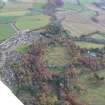
A desk-based assessment and walkover survey were undertaken in June 2004 for an EIA for a proposed flood prevention scheme. Two new archaeological sites were noted: a house and a possible clearance cairn.
Full report lodged with Highland SMR and the NMRS.
Sponsor: Young Associates (Environmental Consultants) Ltd.
S Farrell 2004

