
Scheduled Maintenance
Please be advised that this website will undergo scheduled maintenance on the following dates: •
Tuesday 3rd December 11:00-15:00
During these times, some services may be temporarily unavailable. We apologise for any inconvenience this may cause.
Balvonie Mill


Fishpond(S) (19th Century), Lade (19th Century), Mill (19th Century), Sluice (19th Century)
Site Name Balvonie Mill
Classification Fishpond(S) (19th Century), Lade (19th Century), Mill (19th Century), Sluice (19th Century)
Alternative Name(s) Insches Of Balvonie
Canmore ID 261921
Site Number NH64SE 351
NGR NH 6986 4307
Datum OSGB36 - NGR
Permalink http://canmore.org.uk/site/261921

- Council Highland
- Parish Inverness And Bona
- Former Region Highland
- Former District Inverness
- Former County Inverness-shire
EXTERNAL REFERNCE
Architects: Ross & Joass (I. A. July 15 1864)
For the farmstead see NH64SE 349.
Note (24 November 2010)
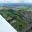
One roofed building and a sluice are depicted on the W bank of a burn running to the SW of Balvonie farmstead on the 1st edition of the OS map (Inverness-shire 1874, xii). The building is not visible on the 2nd edition of the 6-inch map (Inverness-shire 1906, xii) but a series of fish ponds are shown along the course of the burn.
Information from RCAHMS (LMcC) 24 November 2010

