
Cloanlawers


Dam (Period Unassigned), Enclosure(S) (Period Unassigned), Hut(S) (Period Unassigned), Round Ended Building (Period Unassigned), Shieling Hut(S) (Post Medieval)
Site Name Cloanlawers
Classification Dam (Period Unassigned), Enclosure(S) (Period Unassigned), Hut(S) (Period Unassigned), Round Ended Building (Period Unassigned), Shieling Hut(S) (Post Medieval)
Alternative Name(s) Feadan
Canmore ID 24551
Site Number NN64SE 7
NGR NN 68935 42881
Datum OSGB36 - NGR
Permalink http://canmore.org.uk/site/24551


- Council Perth And Kinross
- Parish Kenmore (Perth And Kinross)
- Former Region Tayside
- Former District Perth And Kinross
- Former County Perthshire
NN64SE 7 68935 42881.
NN 687 426. At least nine small rectangular structures, probably shielings, are scattered along two small streams around 475m OD.
Surveyed at 1:10,000.
Visited by OS (JRL) 12 December 1978.
Two unroofed shieling-huts are depicted on the 1st edition of the OS 6-inch map (Perthshire 1867, sheet lviii). Eight unroofed shieling-huts are shown on the current edition of the OS 1:10000 map (1981).
Information from RCAHMS (AKK) 28 October 1997.
NN 68935 42881. The huts described by the OS in 1978 are spread over a very large area, and are now noted under three sites, the other two being NN64SE 80 and NN64SE 90. The two huts depicted on the 1st edition of the OS map are described under NN64SE 90.
Information from RCAHMS (SDB) 13 August 2007
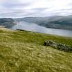
This large group of structures extends for about 500m across the upper edge of a lateral moraine in open moorland above Cloanlawers. It comprises at least forty-six huts, three enclosures, two round-ended turf buildings and a possible dam Some of the huts are extremely fragmentary, and there are doubtless further structures in the area, now reduced to unsurveyable surface irregularities.
Most of the huts are roughly rectangular on plan, though a few of the smaller ones appear to be circular or oval. In the main, they are aligned NE and SW, with entrances (where these are visible) usually in the SE side. They can be divided into three classes on the basis of their construction: thirty-seven have turf walls, five have an internal stone facing encased within an outer shell or embankment of turf, and four are built entirely of stone.
Five of the turf huts are reduced to mounds, in two cases featuring a slight hollow on top to indicate the position of the interior. They measure up to 7.5m by 5.5m overall, and 0.8m in height, and the larger examples probably represent a sequence of superimposed structures (indeed, the largest mound, at NN 69059 43031, is overlain by two later huts, BL00 1962 and 1963). The twenty-nine huts for which internal measurements can be taken range from 1.3m to 5.6m in length (though only six are more than 3.5m long) and from 1.1m to 2.1m in breadth within walls rarely more than 0.3m in height.
Of the five huts of the turf-embanked type, three measure from 4.3m to 4.7m in length and from 1.7m to 2m in breadth within walls up to 0.9m high. One of them (BL00 1959, NN 69030 43032) has an aumbry in the NE end wall, and a turf-walled outshot, or possibly an earlier phase, extends 4.5m to the NE. Another (BL00 1965, NN 69083 43000) has a later pen built over its NE end. The other two huts of this type (BL00 1289 and 1962) are much smaller, measuring internally 2m by 1.4m and 1.3m square; these are likely to have been stores, possibly dairies, rather than dwellings.
The four huts of the stone-built type may represent a final phase of occupation of the site, and may be shepherds' huts rather than true shielings. They are more strictly rectangular than the others, and measure internally from 4.2m to 6m in length and from 1.8m to 2.3m in breadth. Two of them have been robbed to their footings, but the other two (BL00 1293, NN 68800 42638 and BL00 1981, NN 68879 42753) have been furnished with stone gables, which, though partially collapsed, stand up to 1.7m high. One hut (BL00 1981) has an aumbry in its SW gable, an outshot at the NE end, and a low turf mound, probably a midden heap, outside its entrance.
Two of the enclosures stand side by side in a shallow gully at the SW end of the site (BL00 1297-8, NN 6880 4265). Oval on plan, they measure respectively 5.4m by 4.6m and 4.6m by 4.4m within substantial turf banks up to 0.8m in height. The third enclosure, in a burn gully at the NE end of the site, is quite different; of irregular plan, it measures 6m by 4.8m within a roughly-built rubble wall 0.5m in height (BL00 1221, NN 68966 43094). The fourth enclosure, at NN 69098 43008, comprises a slight hollow 4.5m in diameter with traces of a bank around its edge (BL00 1964).
The two round-ended buildings are larger than the huts. One (BL00 1999; NN 68917 42855) stands on a terrace about 20m SW of a possible dam (see below). Oval on plan, it measures 7m in length by up to 3.1m in breadth within turf banks up to 0.4m in height. The interior narrows from the NNE end towards the SSW, and a partition appears to divide it into two unequal compartments, though the supposed partition wall may instead represent a later rebuilding of the NNE half of the building. The other building is situated 160m to the NE, at NN 68994 42999 (BL00 1967). A later turf hut (BL00 1969) has been built over its centre, obscuring its side walls, but the rounded end walls survive, albeit reduced to a height of 0.2m. The building has measured internally 6.9m in length and 3.2m in breadth. These two buildings share similarities with two oval structures recorded in a similar position above the head-dyke at Kiltyrie, about 8km to the SW (see NN63NW 106), and may represent a medieval occupation on the site.
Finally, the possible dam is situated at NN 68931 42871; it comprises a rough line of boulders, about 4m in length, placed across the upper end of a narrow burn gully.
None of the structures described above are depicted on the 1st edition of the OS 6-inch map (Perthshire 1867, sheet lviii), though six of them (BL00 1293, 1297-9, 1981 and 1999) are among the nine shieling-huts in this area identified by the OS in 1978.
(BL00 1220-1, 1289-93, 1295-99, 1950-55, 1958-9, 1961-85, 1993, 1999-2000, 2004)
Visited by RCAHMS (ATW) 28-29 November 2000 and (SDB) 8 July 2004

