
Edramucky Castle


Castle (Medieval), Kiln Barn (Period Unassigned), Township (Period Unassigned)
Site Name Edramucky Castle
Classification Castle (Medieval), Kiln Barn (Period Unassigned), Township (Period Unassigned)
Canmore ID 24502
Site Number NN63NW 4
NGR NN 61990 35910
Datum OSGB36 - NGR
Permalink http://canmore.org.uk/site/24502


- Council Perth And Kinross
- Parish Kenmore (Perth And Kinross)
- Former Region Tayside
- Former District Perth And Kinross
- Former County Perthshire
NN63NW 4 61990 35910.
(NN 6195 3569) Edramucky Castle (NR) (Site of)
OS 6" map (1900)
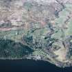
(Area: NN 620 359) The site of the Castle of Edramucky is incorrectly shown by the OS on the peninsula formed by the Edramucky and Morenish burns. The foundations can be distinctly traced to the S of the present farm building, close to the burn of Edramucky and within 200 yds of the loch. Remains of the avenue leading to the castle survive.
J Christie 1892
At NN 6199 3593 there are the distinct remains of at least one and possibly two buildings on a slight plateau overlooking Loch Tay, but themselves overlooked from the N. The clearly defined building measures 6.7m x 3.8m within unmortared, rougly coursed walls 1.0m high by 0.7m wide. The remaining walls in the immediate vicinity are obscured by nettles and bracken. Although this is a more likely site for Edramucky Castle than the OS site, at which there are no remains, it is possible that the buildings are the remains of a steading on the site of the castle.
The site is generally accepted locally as that of Edramucky Castle, and the name "Castle" appears at this position on a Breadalbane estate plan of 1769, by J Farquharson. Name confirmed.
Visited by OS (RD) 9 September 1969
No change to previous field report.
Visited by OS (JM) 9 September 1975
NN 619 359. During the course of a visit to the presumed location of Edramucky Castle (NN63NW 4) to assess the management requirements of the site, some observations were made which supplement those already recorded in the NMRS.
The site is bisected by a modern field boundary, which runs approximately E-W, following the course of a disused dyke. To the N of the boundary is a series of post-medieval rectilinear buildings, including, at NN 6194 3593, a well-preserved kiln barn. The plan of the settlement is obscured by rank vegetation particularly on the W part of the site.
A series of rectilinear foundations occupy the area to the S of the field boundary at c NN 6197 3588. These take the form of raised platforms edged by mounds of overgrown rubble containing some substantial stonework. Although dense bracken prevents any clear understanding of their plan, these foundations seem of quite different character to the structures to the N (and indeed other slighter foundations S of the field boundary) and may represent the robbed remains of Edramucky Castle.
Extensive vegetation clearance is planned for the area and this should in due course reveal considerably more detail of the plan and construction of these buildings.
Sponsor: Historic Scotland
I Armit 1996
Four unroofed buildings, which may be some of the structures seen by Armit, are depicted on the 1st edition of the OS 6-inch map (Perthshire 1867, sheet lxviii). One unroofed building which may be the remains of the castle are shown on the current edition of the OS 1:10000 map (1981).
Information from RCAHMS (AKK) 24 February 1998.
The site of Edramucky Castle is occupied by the ruins of a township comprising seven buildings (including a kiln barn) and an enclosure in wooded ground above the E bank of the Edramucky Burn, and about 200m from the N shore of Loch Tay. The precise position of the castle is not clear, but the most likely site is a revetted platform, measuring 19m by 13.5m, at the S edge of the township (BL00 2038; NN 6199 3588). John Farquharson's 1769 Survey of the North Side of Loch Tay (National Archives of Scotland, RHP 973/1, Plan 5) appears to show this platform, using the style which he usually employs to depict garden enclosures. The Book of Reference accompanying his survey, however, makes clear that the remains of the castle were still visible: 'there is the ruins of an old house likewise a small orchard which is also quite out of order' (RHP 973/2). Farquharson also shows a building to the E of this enclosure, drawn as an unfilled rectangle, in contrast to the township buildings to the N, which are blacked in. He may be depicting a roofless structure, but the site, on sloping ground, is an unlikely position for a castle. No visible remains of this structure survive.
The buildings of the township are all overgrown, several of them have been extensively robbed and some are obscured by piles of rubble. They measure from 6.3m to 17.4m in length and 2.8m to 4.3m in breadth within rubble walls up to 1m in height. Heaps of collapsed rubble at the end walls of at least three of them (BL00 711, 714, 717) may represent collapsed gables. In at least one case (BL00 714) there is evidence for rebuilding on earlier footings; here, a gable-ended building overlies the W end of an earlier structure, 16.5m in length, the rest of which has been reduced to little more than a platform. The kiln barn (BL00 713) stands at the W edge of the township. Measuring 11.5m by 5m overall, it has a substantial bowl at its NNW end, measuring 3.1m in diameter and at least 1.5m in depth.
Apart from the possible roofless building and the enclosure discussed above, Farquharson's map depicts seven buildings and a second enclosure here; six of the buildings can be identified with the remains on the ground (BL00 711-5, 717), and four of those (BL00 711, 713-4, 717) are depicted, unroofed, on the 1st edition of the OS 6-inch map (Perthshire 1867, sheet lxviii).
(BL00 711-7, 2577)
Visited by RCAHMS (ATW and MFTR) 5 July 2000

