
Woodend Of Braco


Hut Circle(S) (Prehistoric), Ring Ditch House (Prehistoric)
Site Name Woodend Of Braco
Classification Hut Circle(S) (Prehistoric), Ring Ditch House (Prehistoric)
Alternative Name(s) Mithergarth; Bennachie Forest
Canmore ID 244593
Site Number NJ72SW 205
NGR NJ 7003 2103
NGR Description NJ 7003 2103, 7003 2107, 6998 2105 and 6998 2101
Datum OSGB36 - NGR
Permalink http://canmore.org.uk/site/244593


- Council Aberdeenshire
- Parish Chapel Of Garioch
- Former Region Grampian
- Former District Gordon
- Former County Aberdeenshire
NJ72SW 205 7003 2103 and 7003 2107
Extends onto map sheet NJ62SE.
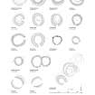
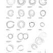
(Formerly entered as NJ62SE 22 at cited location NJ 6998 2112: classified as hut-circle and field-system as GRC/AAS NJ62SE 22). Remains of hut circle (15m external diameter, 9.5m internal diameter) showing as a moss- and grass-covered stony bank with a slightly-sunken interior, in which trees grow. Dip on E side may indicate entrance. A possible disturbed cairn or field clearance heap lies some 20m N.
B Staigner and M Greig 1994; NMRS MS/712/6.
(Formerly entered as NJ62SE 22 at cited location NJ 6998 2112). Two ring-ditch houses are situated on a NE-facing terrace in a forestry plantation 340m SE of Woodend of Braco farmsteading (NJ62SE 32). The larger measures about 9.8m in diameter over a ditch up to 2m in breadth and 0.2m in depth. An external stony bank on the outer lip of the ditch is up to 3m in thickness and 0.3m in height, and a slight depression in its crest on the E probably marks the position of the entrance.
The second house, which lies about 30m to the S, measures about 7.5m in diameter over a shallow ditch. It too has an external bank, measuring 3.6m in thickness and 0.3m in height, and its entrance is marked by a gap in the bank on the E.
Visited by RCAHMS (JRS, IF), 25 July 1996.
(Formerly entered as NJ62SE 24 at cited location NJ 699 210: classified as hut-circle and field-system as GRC/AAS NJ62SE 23). Hut circle and remains of field system: found during tree-felling operations and reported to Grampian Regional Council by Brian Staigner of the Forestry Authority.
B Staigner and M Greig 1994.
(Formerly entered as NJ62SE 24 at cited location NJ 699 210). The hut-circle survives in coniferous woodland, trees having been removed from the interior and the surrounding area; some stones project through the vegetation. It measures 15.3m in diameter externally and 7m internally, the bank having been spread to a thickness of about 4m. The interior is slightly sunken, and the entrance-gap is in the E. Field clearance cairns and stony banks are visible among the trees.
Visited by GRC (Mrs M Greig), 14 April 1994.
NMRS, MS/712/9.
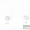
A group of four hut-circles is situated on a NE-facing terrace in a forestry plantation 380m SE of Woodend of Braco farmsteading (NJ62SE 32). Two of the hut-circles, which now lie within a clearing, were previously entered as NJ62SE 22 and NJ62SE 24.
NJ 6998 2105. This hut-circle, the northwesternmost in the group, is a ring-ditch house measuring a maximum of 9.8m in diameter over a shallow ditch up to 2.7m in breadth. An external stony bank on the outer lip of the ditch is up to 4m in thickness and 0.4m in height, and the entrance is on the E.
NJ 6998 2101. This hut-circle, the southwesternmost in the group, lies about 30m S of the first. Oval on plan, its sunken interior measures 9.5m from E to W by 7.5m transversely within a bank up to 3m in thickness and 0.3m in height. The entrance is on the E.
NJ 7003 2107. The northeasternmost hut-circle, which is still covered in coniferous trees, measures about 9m in diameter within a low stony bank and the entrance is on the NE.
NJ 7003 2102. The southeastermost hut-circle, which is also still covered in coniferous trees, measures about 7.2m in diameter within a low stony bank. No trace of the entrance is visible.
Visited by RCAHMS (SPH), 6 November 2002.
Scheduled as 'Mithergarth, ring-ditch houses 280m SSE of... a group of four ring-ditch houses... visible as upstanding features in a mature conifer plantation on a NE-facing terrace on the E flank of Bennachie.'
Information from Historic Scotland, scheduling document dated 9 November 2007.

