
Edinburgh, Holyrood Park, Education Centre


Pavilion (21st Century)
Site Name Edinburgh, Holyrood Park, Education Centre
Classification Pavilion (21st Century)
Alternative Name(s) Park Ranger Station, Pavilion
Canmore ID 240255
Site Number NT27SE 5189
NGR NT 2718 7403
Datum OSGB36 - NGR
Permalink http://canmore.org.uk/site/240255


- Council Edinburgh, City Of
- Parish Edinburgh (Edinburgh, City Of)
- Former Region Lothian
- Former District City Of Edinburgh
- Former County Midlothian
Watching Brief (17 December 2001 - 3 January 2002)
NT27SE 5189 2718 7403
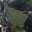
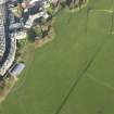
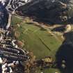
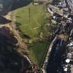
NT 2718 7403 An intermittent watching brief was undertaken in Holyrood Park in November and December 2001 while ground was made ready for the building of a Ranger Pavilion. The site consists of an area of park grassland and trees dating from the beginning of the 20th century. It is presumed to be the result of the levelling over of an earlier landscape, which may originally have been market gardens and orchards of a monastic date.
Work also continued for one day in January 2002
G Ewart and D Stewart 2002
Sponsor: HS
Kirkdale Archaeology
Watching Brief (August 2002)
In August 2002 Kirkdale Archaeology undertook a short Watching Brief at the Broad Pavement area of Holyrood Park.
G Ewart 2002
Sponsor: Historic Scotland
Kirkdale Archaeology
Excavation (4 July 2002 - 5 July 2002)
NT 270 740 An intermittent watching brief was undertaken between March and July 2002 in Holyrood Park during the excavation of a service track for the new Education Centre (on the site of the Park pavilion) to Croft an Righ. For most of its length, this cutting was up to 600mm deep and 0.5m wide.
The entire line of the track (other than where it crossed the existing road next to the Palace E wall) was limited to the removal of turf and garden soil (F001) over some dumped mixed grey silt with several small stone fragments (F002). The general ground level which presently defines the park and parade ground area is the result of extensive landscaping. This was noted during the clearance works associated with the construction of the present Education Centre (see Kirkdale Archaeology report: ‘Archaeological monitoring of excavations for new pavilion: November/December 2001’ submitted 6th March 2002) and is most likely part of the general levelling and planting programme of the later 19th century. The present pathways and avenues all date from this period which saw the deposition of c.300mm of garden soil over more mixed soils and stony fills. The presence of midden and shell in the lower ‘fill’ deposits may reflect significant redeposition of local dumps emanating from general post medieval activity along the Canongate, prior to the improvements to Park and Palace in the later 19th century.
Only a short section of the track was cut through the Palace E wall road between the edge of the park and the cobbles of the road next to Croft an Righ. Below the actual road metalling (F003) and bedding material (F004) further dumps of midden-rich material were found (F005). The latter was gradually replaced by a spread of gritty tarry silt (F006) – a levelling deposit for maintaining a consistent road level in the vicinity of the Pump House. This has in turn created a pronounced slope down to the adjacent cobbled road lying next to Croft an Righ itself and St Anne’s Workshops (to the E).
G Ewart 2002
Sponsor: Historic Scotland
Kirkdale Archaeology
Watching Brief (13 June 2002)
NT 270 740 An intermittent watching brief was undertaken between March and July 2002 in Holyrood Park during the excavation of a service track for the new Education Centre to Croft an Righ.
G Ewart 2002
Sponsor: Historic Scotland
Kirkdale Archaeology

