
Pricing Change
New pricing for orders of material from this site will come into place shortly. Charges for supply of digital images, digitisation on demand, prints and licensing will be altered.
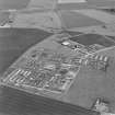
Crail Airfield


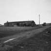
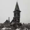
Building(S) (20th Century), Chapel (20th Century), Hut(S) (20th Century), Military Camp (20th Century), Water Tank (20th Century)
Site Name Crail Airfield
Classification Building(S) (20th Century), Chapel (20th Century), Hut(S) (20th Century), Military Camp (20th Century), Water Tank (20th Century)
Canmore ID 238409
Site Number NO60NW 49.12
NGR NO 6168 0918
Datum OSGB36 - NGR
Permalink http://canmore.org.uk/site/238409


- Council Fife
- Parish Crail
- Former Region Fife
- Former District North East Fife
- Former County Fife
NO60NW 49.12 centred on 6168 0918
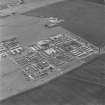
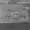
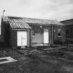
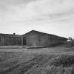
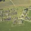
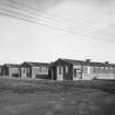
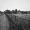
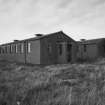
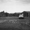
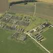
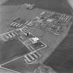
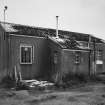
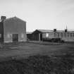
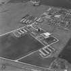
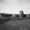
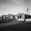
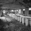
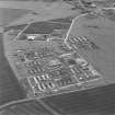
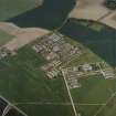
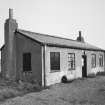
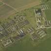
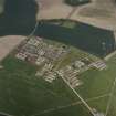
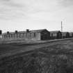
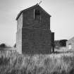
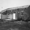
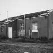
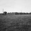
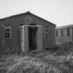
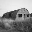
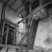
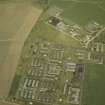
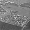
The accommodation camp for Crail Airfield is situated to the N of Kirklands farmsteading. occupying about half a hectare of land where many of the huts, buildings and structures survive. Around 57 huts in varying stages of decay are spread between Kirklands and Wormistone farmsteadings. Many are in use for agricultural purposes and several of the roads between the huts have been used to dump earth. The perimeter fence is still in situ and entrance gates still in place.
The camp is visible on RAF vertcial air photographs (106G/Scot/UK 5, 4081-4082, flown 14 April 1946) and it is also visible on a RAF WW II vertcial air photograph (NLA 14, 997, flown 19 June 1941).
Visited by RCAHMS (DE), Janaury 2005

